Land Surveyors United - Global Surveying Community
Prism Training and Mentorship App

For All Land Surveyors - Best of Both Worlds
Prism Education App: http://go.srvyr.com/prism
This app not only aggregates the shared advice and questions from the other 2 apps, it is packed with surveying basics, surveying articles, resources, live events and more. Add this app to your phone to see content shared from both the New Surveyor App and the Old Surveyor App.

Learn More: https://landsurveyorsunited.com/.../help-the-community...

-----------------------
This app was developed by Justin Farrow on behalf of the Land Surveyors United Community. If you would like to help improve the app, consider making a donation to help with upgrade and help us help more surveyors around the world.
https://landsurveyorsunited.com/donate

Enclosure: https://landsurveyorsunited.com/hubs/mentorship/photos/prism-mentorship-app
Reply to this post...
New Surveyors App - Find Mentors

For Those New to Surveying
New Surveyor App: https://go.srvyr.com/newsurveyor

It is no secret that the boss doesn't understand you. You are most likely from a different generation and/or may have a different style of learning. One thing is for certain - you do not know what you are doing and that is ok. But imagine being able to save yourself the embarrassment of asking a surveying veteran a simple question about something which you are already expected to know. By asking for advice inside the New Surveyor App, you are asking ALL of the experienced surveyors in the community and crowdsourcing the answers. Not only that, you'll have the advice and expectations shared by your Party Chief so everyone is on the same page.

Learn More: https://landsurveyorsunited.com/.../help-the-community...


-----------------------
This app was developed by Justin Farrow on behalf of the Land Surveyors United Community. If you would like to help improve the app, consider making a donation to help with upgrade and help us help more surveyors around the world.
https://landsurveyorsunited.com/donate

Enclosure: https://landsurveyorsunited.com/hubs/mentorship/photos/new-new-removebg-preview
Reply to this post...
Surveyors Dictionary App

Land Surveyor Dictionary App

https://surveyordictionary.glideapp.io/

Carry a mobile Land Surveying Dictionary and Land Measurement Conversion Guide with you for quick reference. Brought to you by Land Surveyors United Community https://landsurveyorsunited.com

------------------------
This app was developed by Justin Farrow on behalf of the Land Surveyors United Community. If you would like to help improve the app, consider making a donation to help with upgrade and help us help more surveyors around the world.
https://landsurveyorsunited.com/donate

Enclosure: https://landsurveyorsunited.com/hubs/mentorship/photos/surveyor-dictionary-app
Reply to this post...
USA Land Surveyors App

USA Land Surveyors App
https://usalandsurveyors.glideapp.io

Quick links to all USA Land Surveyor Hubs and Forums with quick access to adding discussions, photos and videos of land surveying in your state.

-----------------------
This app was developed by Justin Farrow on behalf of the Land Surveyors United Community. If you would like to help improve the app, consider making a donation to help with upgrade and help us help more surveyors around the world.
https://landsurveyorsunited.com/donate

Enclosure: https://landsurveyorsunited.com/hubs/mentorship/photos/usa-surveyorsapp
Reply to this post...
elevation level loop user journey


📐 Land Surveyor Elevation Level Loop Journey

* Step 1: Gather Equipment

* Collect all necessary tools and equipment for the elevation level loop survey.
* * Total Station
* * Tripod
* * Prism Pole
* * Leveling Rod
* * GPS Receiver (optional)

* 🟢Step 2: Select Benchmark

* * Choose a reliable and well-established benchmark with known elevations.
* * Research local benchmark database or consult with relevant authorities
* * Identify the benchmark's elevation and reference it for the survey

* 🟢 Step 3: Set Up Total Station

* * Prepare the total station for the elevation level loop survey.
* * Set up the tripod on stable ground
* * Mount the total station securely on the tripod
* * Level the total station using the built-in leveling mechanism

* 🟢 Step 4: Establish Control Points

* * Establish control points around the property for accurate measurements.
* * Select at least three control points
* * Use the total station to measure and record their positions
* * Ensure these control points are visible and accessible throughout the survey

* 🟢 Step 5: Perform Elevation Level Loop

* * Set up the prism pole at the first control point
* * Measure the elevation at the first control point using the total station
* * Move to the next control point and repeat the measurement process
* * Continue until all control points are surveyed
* * Calculate the elevation differences between the control points

* 🟢 Step 6: Adjust Elevations

* * Adjust the surveyed elevations to tie them to the selected benchmark.
* * Apply the known elevation of the benchmark as a reference
* * Determine the elevation correction factor
* * Add or subtract the correction factor to each surveyed elevation

* 🟢 Step 7: Finalize and Document

* * Complete the elevation level loop survey and document the results.
* * Verify the accuracy of the survey measurements
* * Prepare a detailed survey report including the benchmark tie-in
* * Store all collected data and measurements for future reference


Enclosure: https://landsurveyorsunited.com/hubs/mentorship/photos/elevation-level-loop-user-journey
Reply to this post...
Quick Access Surveying Jobs By Location

 this is a new way to see all of the latest available Surveying Jobs by Location, at a glance.

Latest Available Land Surveying Jobs USA, Asia, Europe, Africa

Latest Available Land Surveying Jobs USA, Asia, Europe, Africa

Latest Available Land Surveying Jobs North America, South America, Oceania, Middle East

Latest Available Land Surveying Jobs North America, South America, Oceania, Middle East

 Surveyor Seeking EmploymentLand Surveying Jobs By Type

 3D Laser Scanning Jobs

Job Search Tips

Instrument Man Job

Party Chief Jobs

Survey Office Jobs

Quantity Surveyor

Land Survey Consultant

GIS Jobs

ALTA Land Surveyor

Construction Surveyor

Pipeline Surveyor

Land Survey Technician

Civil Engineer Jobs

Survey Rodman Jobs

Land Survey Internships

Surveying Articles


Related Toolkits for Land Surveyors

 View All Toolkits

Surveying Business Toolkit      

Surveying Business Toolkit

Surveying Jobs Toolkit 

Surveying Jobs Toolkit

Experimental Surveyor Training Apps

Surveying Training Toolkit

Enclosure: https://landsurveyorsunited.com/hubs/mentorship/photos/latest-land-surveying-jobs-by-location
Reply to this post...
Seasoned Surveyors App

For the Seasoned Surveyor
Seasoned Surveyor App https://go.srvyr.com/seasonedsurveyor

Imagine a world where you only had to say something once. Imagine the removal of frustrations involved with teaching the greenhorn the basics. If you were to add your expectations and advice to the app and then just ask the new surveyors to add the app to thier phone, they will have all of your instructions and knowledge on that phone they have a hard time putting down.

Learn More: https://landsurveyorsunited.com/.../help-the-community...


-----------------------
This app was developed by Justin Farrow on behalf of the Land Surveyors United Community. If you would like to help improve the app, consider making a donation to help with upgrade and help us help more surveyors around the world.
https://landsurveyorsunited.com/donate

Enclosure: https://landsurveyorsunited.com/hubs/mentorship/photos/seasea-removebg-preview
Reply to this post...
Global Surveyors App

Global Surveyors App
https://globalsurveyors.glideapp.io/

International Surveying Hubs and Forums
by Land Surveyors United
Land Surveyors United Members UNITE! Find your country and either introduce yourself or tell us something about surveying in your area of the world! http://landsurveyorsunited.com

------------------------
This app was developed by Justin Farrow on behalf of the Land Surveyors United Community. If you would like to help improve the app, consider making a donation to help with upgrade and help us help more surveyors around the world.
https://landsurveyorsunited.com/donate

Enclosure: https://landsurveyorsunited.com/hubs/mentorship/photos/global-surveyors-app
Reply to this post...
Land Survey Equipment Support App

Land Survey Equipment Support App

https://equipmentsupport.glideapp.io/

by Land Surveyors United
Find help with your Land Surveying Equipment from the field with quick links to forums, share photos and videos inside Land Surveyors United Community

------------------------
This app was developed by Justin Farrow on behalf of the Land Surveyors United Community. If you would like to help improve the app, consider making a donation to help with upgrade and help us help more surveyors around the world.
https://landsurveyorsunited.com/donate

Enclosure: https://landsurveyorsunited.com/hubs/mentorship/photos/surveysupportequipapp
Reply to this post...
Surveyors for Hire Recruiters App

Surveyors for Hire App for Recruiters

https://hiresurveyors.glideapp.io/

Looking for a Surveying Job? Create your resume by filling out the following form and you will be shown here in our Surveying Jobs Resume Pool: https://go.srvyr.com/cvpooladd

------------------------
This app was developed by Justin Farrow on behalf of the Land Surveyors United Community. If you would like to help improve the app, consider making a donation to help with upgrade and help us help more surveyors around the world.
https://landsurveyorsunited.com/donate

Enclosure: https://landsurveyorsunited.com/hubs/mentorship/photos/hire-land-surveyors-app
Reply to this post...

Land Surveyor Blogs - Land Surveyors United - Global Surveying Community
✊✊✊ 18,000+== Land Surveyors Strong 💥💥💥

Wow... Another 300+ Surveyors have joined the community since the last milestone, putting us at over 16,900+ members worldwide on Land Surveyors United!!!

We also crossed 37,000 members inside our Private Group https://facebook.com/group/landsurveyors

Land Surveyors United Community is now  18,000+ Land Surveyors Strong

Help us get to 19k by joining us today on https://landsurveyorsunited.com/community

Those of you who have taken the leap from Facebook and joined our Personal Development Community for Land Surveyors, we thank you! Our land surveyor community reached a new milestone yesterday - we accepted our 16,900th member and counting. Do you realize how incredibly rare that is? ...the most rare and we thank you for being a part of it. We will definitely cross 17k members before the end of the summer!

For those who have made the small leap to our official community at https://landsurveyorsunited.com/hubs we thank you. Because of you Land Surveying will NEVER DIE! It will never be replaced either. Many aspects of land surveying can never be automated without sacrifice to precision and passion. My dad's passion for helping surveyors extends beyond the grave and continuously inspires me to lift this community up, bring the members together and help them to help themselves and one another. Never influenced by advertising dollars , we are here to help each other become better surveyors and provide breadcrumbs for future surveyors to follow..

Although many continue to flock to Facebook Groups and Instagram for a quick fix, Land Surveyors United Community continues to grow. Many are starting to realize that posting photos and stories on Facebook is great for a moment but when it comes to sharing something meaningful which lasts forever and inspires future generations of land surveyors, post it to Land Surveyors United.

Our community extends in all directions. We need YOU to keep it growing! Thank you for all of your contributions and support over the years!

Add a term to the #Geoalmanac for Land Surveyors and promote your company at the same time!!! https://landsurveyorsunited.com/almanac

Find your Location Based Hub https://landsurveyorsunited.com/locations

Interested in Mentorship? Follow this new hub https://landsurveyorsunited.com/mentorship

We have new Hubs for Virtual Events
https://landsurveyorsunited.com/hubs/virtual-geo

Podcasts
https://landsurveyorsunited.com/hubs/podcasts

Lidar
https://landsurveyorsunited.com/hubs/lidar

For equipment, check out http://equipment.srvyr.com

Many new improvements to the Surveying Jobs page.... Looking for Jobs? start here: https://landsurveyorsunited.com/jobs

For Mobile Apps -- All of our apps are full screen now!
https://landsurveyorsunited.com/apps

Our Growing Marketplace
https://landsurveyorsunited.com/marketplace

Have you looked over the Community Roadmap for 2020? https://landsurveyorsunited.com/roadmap
---------------------------------------
Follow us on Twitter because we share your #surveyingmoments there! https://twitter.com/landsurveyorsU
Follow Our Group on Linkedin with over 7000 Surveyors... https://www.linkedin.com/groups/1330467/
We also have a company page on Linkedin starting to see some numbers...https://www.linkedin.com/company/2724921/


If you have not yet joined the Official Community, what are you waiting for?? Share this and help us grow!

Enclosure: https://landsurveyorsunited.com/profiles/blog/list/16-900-land-surveyors-strong
Reply to this post...
Which are the best 3D architectural rendering companies in USA?

INDOVANCE Inc delivers interactive, realistic, and immersive experiences through detailed 3D Walkthroughs with architectural renderings. Our services include Real Estate Projects, Industrial Walkthroughs, 3D Virtual Art Galleries, Furniture Animation, and Virtual Room Design Services for Interior and Exterior designs. With nearly two decades of experience working on a variety of engineering projects, INDOVANCE Inc provides advanced and unprecedented 3D CAD design services.

We strive to give its clients the Assurance and Confidence they need to make the best strategic decisions for sustainable and safe design solutions.

The INDOVANCE Experience promises high-quality deliverables with cost-benefits, enhanced visualization, forecasting capabilities, easy maintenance & remodeling, compliance with international codes & standards, quick turnarounds for competitive advantage, and easy integration for increased control over the design process.

Give your VISION a shape of REALITY - Connect with the Creative Crew 

Enclosure: https://landsurveyorsunited.com/profiles/blog/list/which-are-the-best-3d-architectural-rendering-companies-in-usa
Reply to this post...
GIS ANALYSIS AND REPORTING by Himanshu's Survey Team
4397633349?profile=RESIZE_710xGIS ANALYSIS AND REPORTING
Himanshu's Survey Team takes a holistic approach of spatial data creation, GIS database organization, quality maintenance, frequent updates as per new developments, and can provide user friendly technology that enables customers to understand and use GIS data. 

We have skilled surveyors who are able to establish high accuracy survey control networks and can undertake detailed topographical surveys annotating virtually every single structure, object, furniture or ground change present while minimising any impact our survey work and activities create for the general public and the surrounding environment. 
 
Within the india, over the past decade we have successfully completed several railway surveying projects on the Network Rail Infrastructure, ranging from standard topographical and gauging surveys for a number of railway stations across the country, to working as a principal surveying contractor on complex and multidisciplinary railway construction projects. For such projects, the requirement was to undertake various topographical and engineering (setting out) surveying and mapping services, ranging from track surveys and as-built surveys to various embankment, drainage and track setting out surveys. This includes the installation of modular S&Cs and various other traditional topographical and high precision engineering survey activities (for example, structural gauging for clearance purposes, signal surveys, S&T cable routes surveys, drainage and catchpit surveys and embankment surveys for stabilisation and re-profiling purposes).
 
Mission And Values
The mission of our business is to provide a first-class land surveying service to clients and businesses first time round. Our company values are based on building an outstanding company reputation while providing a bespoke service and expertise to every land surveying project and inquiry we receive from clients, while strictly adhering to industry standards and specifications.
 
 
Building Surveying Methods
Measured building surveys can be undertaken using various surveying methods and technologies, ranging from measuring tape and Disto to employing Total Stations, laser scanners and advanced photogrammetric techniques (mainly to produce drawings of complex elevations). Floor plans generally involve taking measurements of all structural openings, room fixed furniture, doors, windows, overhead beams and other similar features and structures.

In comparison, elevations generally involve the preparation of detailed drawings showing every feature of the building face or elevation subject to survey. Nevertheless, measured building surveys can include a much more detailed specification from the one mentioned above and, if needed, can include every socket, brick and pillar, no matter the project size or building complexity.
 
TYPES OF SERVICES
 
Archaeological Surveys | As-built | Coastal Surveys | Consulting Services (Geomatics) | Close-range Photogrammetry | Data Validation | Drainage & Utilities Surveys DWG & DGN Files | Earthworks & Volumetric Surveys | Engineering Surveys | Expert Witness Services | Gauging & Clearance Surveys | Geotechnical & Borehole Surveys GENIO Files | GPS Surveys | GPR Surveys | Level Surveys | Ground Modelling & Visualisation | Heritage Surveys | Road & Highway Surveys | 2D Floor Plans & Elevations Land Condition Surveys | Measured BuildingSurveys | Monitoring & Deformation Surveys | Mining Surveys| Permanent Way (Railway) Surveys | Project Management River & CanalsSurveys | Setting Out Services | Sections & Profiles | Survey Control Networks | Terrestrial Laser Scanning | Technical Report Writing Topographical & Mapping Surveys | Tree Surveys | Tunnel Surveys | Training & Mentoring Services | TruView Files | UTX & URX Surveys | Vegetation Surveys  
Enclosure: https://landsurveyorsunited.com/profiles/blog/list/gis-analysis-and-reporting-by-himanshu-s-survey-team
Reply to this post...
Open Call for Survey Course Instructors and Book Authors

Do you teach courses in Land Surveying?  

We want to include your courses inside our new Survey School App which should roll out in early January.  The Survey School App includes both free and premium courses for learning all aspects of Land Surveying.   Here are a few screenshots of the new Survey School App:

8312087471?profile=RESIZE_400x8312087490?profile=RESIZE_400x8312087873?profile=RESIZE_400x8312088467?profile=RESIZE_400x8312088669?profile=RESIZE_400x8312089266?profile=RESIZE_400x


Loading…


Do Your Write or Sell Books about Land Surveying?

If you are a book author who would like to have your books on display and for sale inside the Smarketplace Vitual Mall, in the book store (an inside the Smarketplace App), we want to know more about your books.   One of the most searched for items inside the community are good books about land surveying.  Please tell us more about yourself and your work and we will be in touch soon to add you to the mix.

Loading…


We are actually putting the final touches on 2 new Member Apps (which include practically every other app in the Surveyor App Suite).    These apps will be for all Land Surveyors United Members and can be signed into with the same email as you use to log into the community.  More updates on this throughout the week!


Enclosure: https://landsurveyorsunited.com/profiles/blog/list/open-call-for-survey-course-instructors-and-book-authors
Reply to this post...
Quickly See the Latest Available Surveying Jobs Around the World

You may remember the Toolkits we released last week for Surveying Businesses and Job Seekers.   Well, this is a new way to see all of the latest available Surveying Jobs by Location, at a glance.

Latest Available Land Surveying Jobs USA, Asia, Europe, Africa

Latest Available Land Surveying Jobs USA, Asia, Europe, Africa

Latest Available Land Surveying Jobs North America, South America, Oceania, Middle East

Latest Available Land Surveying Jobs North America, South America, Oceania, Middle East

 Surveyor Seeking EmploymentLand Surveying Jobs By Type

 3D Laser Scanning Jobs

Job Search Tips

Instrument Man Job

Party Chief Jobs

Survey Office Jobs

Quantity Surveyor

Land Survey Consultant

GIS Jobs

ALTA Land Surveyor

Construction Surveyor

Pipeline Surveyor

Land Survey Technician

Civil Engineer Jobs

Survey Rodman Jobs

Land Survey Internships

Surveying Articles


Related Toolkits for Land Surveyors

 View All Toolkits

Surveying Business Toolkit      

Surveying Business Toolkit

Surveying Jobs Toolkit 

Surveying Jobs Toolkit

Experimental Surveyor Training Apps

Surveying Training Toolkit


Enclosure: https://landsurveyorsunited.com/profiles/blog/list/quickly-see-the-latest-available-surveying-jobs-around-the-world
Reply to this post...
Reflective Survey Targets

Just Retros a Sydney, Australia based reflective target supplier is pleased to annouce that it can now offer RE-BRANDING on our target range, that means you can have your own company logo on your targets.

We are also pleased to annouce we are able to offer consecutive numbering for our targets so each target is unique.

Prices for targets with your logo are the same as shown on our website. A minimum order quantity of 2,000 is required.

Check out the website, inquires are welcome.

Enclosure: https://landsurveyorsunited.com/profiles/blog/list/reflective-survey-targets
Reply to this post...
Digest: 🧠 Massive Updates to Community - New Toolkits and Features -👀

Welcome to all of our new members of the Community!   I have taken the past 2 weeks to dramatically trim down and scale back over 11,000 pages inside the community, making the pages load MUCH faster and making it more organized and compact.  I still have much work to do but some of the changes you'll now notice are the following:

Breadcrumb Navigation throughout the community, making it simpler to navigate and  find your way back to where you started. Examples: Jobs,   Forums , Toolkits  , Articles Your Member Profile is much more organized and you'll find it much simpler to quickly add content to the community.  You'll also see that you can quickly find jobs, equipment deals and navigate to resources easier through your profile. New dedicated pages for those who are Seeking Employment and for those who are Now Hiring New page for finding Surveying Jobs by Location - the first module you see will show you available jobs near you as soon as you land on it. Surveyor Mentorship and Surveying Knowledge Exchange Project Your experience in Land Surveying is priceless to the next generation. But more importantly, it is the glue which holds your crew together.  We are trying something new as a community in order to attempt to improve inner crew communication across generations. 


New Toolkits and Features

Land Surveyor Radio Toolkit: All the Surveyor Podcasts in One Place Marketplace Toolkit: New Megashop Brings The Entire Smarketplace Together Toolkit for Surveying Businesses Land Surveying Company Directory for USA

Land Surveyor resources and toolkits

Enjoy, explore and contribute your surveying experiences to our community....a living library of land surveying which is not controlled by 3rd party interests- it is controlled by you, the surveyor. No one else in the world, aside from our community members, catalogs changes in the surveying industry. No one else focuses on collecting, curating and showcasing the importance of land surveyors to society for future generations to learn from and to promote public awareness of this importance.  We do and thank you for being a part of this effort.

It takes just a few moments per week for you to curate a rock solid legacy in surveying right from your LSU Profile, and every minute you spend sharing your experience will breathe ten years of life into the profession.  Everything you add to this community will someday outlive all of us..which is why I spend so much time doing what I can to make our network as sustainable as possible without having to rely on 3rd parties.

I sincerely hope you'll take a moment to check out all of the new additions and use them to accomplish your goals. As a 15 year old community, a LOT of time goes into keeping this community organized and functioning for all the surveyors out there.  Future generations are relying on us to support them with surveying knowledge.  I am simply trying to do my part by providing a place to do just that.  Your donations to help with upkeep and maintenance are always appreciated and they help tremendously with our community bills and they keep the community moving forward. 

Have a great weekend!

Justin

Enclosure: https://landsurveyorsunited.com/profiles/blog/list/digest-massive-updates-to-community-new-toolkits-and-features
Reply to this post...
introduction from the shadows

Hey Gang,

Wanted to start by wishing a Happy Suveyors Week to all of our hard working members out there here in the States and around the Globe. 

I have been working behind the scenes with Land Surveyors United for several years now and we have decided it is time for me to emerge from behind the curtain and start being a more active part of the site.  I look forward to getting to know you all in some way and am really excited about trying to share some content and bounce ideas off of all of you - the life blood of this community!  

While I am not a Surveyor by trade, it is something that has fascinated me for a long time.  Seeing the changing dynamics of the field and the ever increasing technological advancements, as well as, the old school methodology is a huge part of why I genuinely belive this is one of the most important professions out there.  Technically I come from a legal background, but please don't hold that against me - haha.  I have tried to take some of that knowledge and fold it into hopefully being a beneficial part of this operation.  We are a very small group - but we are also very passionate about what you guys do and how you do it.  

I really look forward to sharing some ideas and sparking some dialogue amongst the members and hope to give you guys some really interesting content and media along the way.  Please don't hesitate to make suggestions about what kind of things you the members would like to see going forward, whether that's the topics we delve into or how the site itself operates.  This is a site FOR Land Surveyors and we always want your feedback.

Thanks for taking the time and have a great week out in the field or in the office - whichever it is that you are helping to keep things measured properly.

Surveyors Rule when they are United!

- Chris (from the A to Zenith team)


Enclosure: https://landsurveyorsunited.com/profiles/blog/list/introduction-from-the-shadows
Reply to this post...
GIS Mapping For Pipeline Construction- Oil & Gas Industry l Arcengine

            Surveys are the demanding stage of the construction of the assignments. Construction survey of the pipeline for oil and gas requires expert engineering analysis, this pipeline needs accurate route survey and route selection. The GIS (geographic information system) mapping provides all types of geographical data for surveying the route. Arcengine makes sure to give the best service drafting the project most efficiently and accurately.
            Many factors are affecting the survey to be studded subsequently. While pipeline construction surveys of oil and gas there are many circumstances to go through, GIS proves the most efficient and reliable technology for accurate surveys to overcome difficult circumstances.


Request For Free Trial: https://thearcengine.com/contact/?utm_source=mz

GIS mapping and technology
About:
             A Geographical information system (GIA) is designed to store multiple geographical data in one application. GIA manages, analyses, store and capture the information for the surveying the land for oil and gas. It proves to be a reliable tool to navigate regional difficulties. It is a problem-solving device with advanced technology that helps in proper decision making and also used for visualization of land data in the exact environment. Oil and gas pipeline is one of the most difficult projects to work on; Arcengine makes sure to help you in all difficulties solved in the best way possible.


            Raster and vector are two types of main data stored in GIA, this data is time saving when evaluating and re-evaluating the land for pipeline construction. GIS mapping helps in finding the topography of the land to find the right of way for oil and gas pipeline construction, geographic data and elements consist of are latitude, longitude, location, foreign pipeline, other construction, topography, demography, privately owned property, etc.
          GIC (geographic coordination system), IFC alignment, 3dimentional visuals, geospatial, plat map are few features Geographical information system(GIS) mapping consists of.

See Our Recent Projects: https://thearcengine.com/architectural-drafting-services/land-survey-drafting/


Use of GIS mapping in the oil and gas pipeline construction survey:

The right of way or route of the pipeline is to be trench across a flat surface with a constant temperature. While survey and planning pipeline (oil and gas) right of way GIA mapping provides information about the land. Finding the right of way is a tough job in taking consideration of other geological structures creates major difficulties, some land difficulties faced while the survey is a mountain, desert, roads, localities, vegetation, huge rocks, fluctuation in temperature, etc. GIA provides this information on a single 3d map with custom removable layers of map data it makes it easy for the surveyor to survey the land in the right of way.
Surveyors need not go on the field every time to draft survey the obstacles or measurements of the land.

Advancement in the survey due to GIS / Advantages due to GIS

GIS simplifies workload by including all kinds of land information on one board.GIS consist of technology like IFC alignment, topography/ elevation, GCS (geographic coordinate system), demography, other construction, and foreign pipeline identification can also be done.In the construction of the oil and gas pipeline, GIS provides a better understanding to solve the problem of ground level.Geographical information system mapping exhibits visual information of elevation as well as a plat map.Underground information such as tunnels, bridge construction can also be surveyed through GIS, it proves to be reliable technology for the survey.Advance information like 3d data of geography, landmarks, tower, etc is to be included in the GIA map application.GIS mapping technique proves to be cost-efficient and time-saving as it provides land information in one software.It helps in clear understanding and better information.

Construction and survey with GIS mapping technology, Survey Planning, and drafting of construction projects need accurate data, the information needed about obstacles, land topography, locality, water bodies, roads, latitude, elevation, demography, etc are fulfilled while surveying the land. GIS technology combines all information in one place.

Arcengine helps you in drafting the survey of the oil and gas pipeline in the most conducive way. Drafting Service efficiently provided by Arcengine are


ALTA survey
• Topographic survey
• Boundary survey
• Route survey
• Mortgage survey
• Tower survey and tower AWS architecture
• Subdivision survey

Surveying the pipeline construction site for oil and gas has always been the basic and most important aspect in surveys that need precision in drafting to clearly depict all components of the survey. CAD drafting has been proven accurate for drafting all kinds of projects. Here at Arcengine, we make sure to provide exact drafting and information with the help of GIS tools.


To Know More Visit:- https://thearcengine.com/?utm_source=mz

Get In Touch:
https://twitter.com/TheArcengine
https://www.instagram.com/the_arcengine/
https://www.linkedin.com/company/14621913
https://www.pinterest.com/thearcengine/
https://www.facebook.com/the.arcengine/

Enclosure: https://landsurveyorsunited.com/profiles/blog/list/gis-mapping-for-pipeline-construction-oil-gas-industry-l-arcengin
Reply to this post...
A Little More About Me (Wyatt Collins, EIT, LSIT)

This is my first time on this forum and my first blog post so bear with me.  One thing I have learned about myself is that my perfectionism can get in the way.  On that note, I decided recently to take a different tact.  There is a book which talks about this phenomenon (among other invaluable topics) called Atomic Habits, by James Clear.  The author also writes about it on his website (at https://jamesclear.com/repetitions) in an article entitled, "Why Trying to Be Perfect Won't Help You Achieve Your Goals (And What Will)".   So I am now trying living by John C. Maxwell's quote, "Fail early, fail often, but always fail forward".   So without further ado, here is a little bit about me.

Construction and engineering have always been an integral part of my life. Throughout my teens, I worked for my uncle’s construction company (Dan Collins Concrete) in Klamath Falls, Oregon as a laborer and a finisher. This led to other opportunities such as remodeling houses for Derek Van Der Werf, a property manager in Tempe, Arizona who had previously contracted my father for some concrete work (Concrete by Dave, http://concretebydave.com/).  I also worked as a finisher and a laborer for my Dad's company.  He started the company after the 2007 stock market crash and I was his first recruit, even looking at jobs for estimates and coding his website in HTML and CSS.  At this point, I knew I had a passion for learning and growing so that I could help build a better future. I could take the skills I learned from construction and apply them to local and global projects. This is the reason why I pursued my bachelor’s degree in Civil Engineering from Arizona State University (Graduation: May 2017).

During junior year, I had a summer Transportation Engineering Internship at AECOM in 2016.  Given my decade of experience in residential/commercial construction, I became a Heavy Civil Highway Construction Inspector at Raba Kistner. In the last three years, I worked on the Loop 202 South Mountain Freeway Expansion Project. For me, this project taught me the importance of soft skills. Throughout the process, I collaborated with various parties such as subcontractors, agencies (e.g. ADOT, EPA, and SRP), and tribal members in addition to my colleagues at Raba Kistner. All in all, I learned that soft skills like communication and adaptability are imperative to complete projects within a timely manner.  I was also able to attain my Engineer in Training (EIT) certification by passing the Fundamentals of Engineering (FE) Exam, along with several others (e.g. ACI, ATTI, ATTSA certifications).  As a life-long learner, I have continued to develop myself. In February 2020, I passed the Land Surveyor in Training (LSIT) exam. After gaining some essential surveying experience, I hope to take the PS exam so I can become a Registered Land Surveyor.  In the long run, I think it would be great to become a Registered Professional Land Surveyor and a Professional Engineer.  The tools, knowledge, and resources gained along the way will help me provide more value, a higher quality of life, and a sense of meaning/purpose/fulfillment to myself, my loved ones, and society at large.

I am writing this post amid a situation of socioeconomic uncertainty and turbulence brought on by the coronavirus pandemic.  The economy was booming before the current state of affairs and I hope it continues to do so in order that people can get (and stay) on the right track towards betterment of themselves and others.  In these times, it is important to connect, innovate, hustle, adapt, and motivate.  That is, we need to lift ourselves and those around us up and strive for a better future.  A future of more equal socioeconomic opportunity.  A future more resilient and less fragile.  If you want to connect you can reach me via LinkedIn at: https://www.linkedin.com/in/wyatt-collins-eit-lsit-9085204b/

As of April 2020, I am looking for a new career opportunity.  I am currently residing in Tempe, Arizona where my girlfriend is finishing her degree in Aerospace Engineering (1 year left).  If you have any questions or leads, feel free to reach out!

Enclosure: https://landsurveyorsunited.com/profiles/blog/list/a-little-more-about-me-wyatt-collins-eit-lsit
Reply to this post...

Surveying Articles - Land Surveyors United - Global Surveying Community
National Surveyors Week, Surveying Jobs and Resources - oh my!


10235948071?profile=RESIZE_400xHappy National Surveyors Week and we hope you are doing well.   This has been an entire week of celebrating the Land Surveying profession, here in the USA.  This week we accepted our 19,600th member, got a new home page for the community and we've been celebrating with all of you.  It truly has been an uplifting week for land surveyors.  If you would like to learn more about National Surveyors Week, look here.  If you would like to check in an drop a message for your fellow surveyors, you can do that here.  Thank you for helping us inspire the next generation of land surveyors by socially supporting your fellow surveyors.  

National Surveyors Week is a time to not only celebrate the Land Surveying Profession, it is a time to gain exposure for your company and strengthen the surveying community!  In our community, we feel it is also perhaps the best time of year to educate the public regarding the importance of land surveyors to society and civilization.

Please Add One Surveying Photo or Video to your Local Hub inside Land Surveyors United!

Here are a few quick things you can do today to support the community and promote your surveying legacy:

List Your US Land Surveying Company inside Our Directory for United States Land Surveying Companies. Add Your Available Surveying Jobs to the Jobs Board for Land Surveyors. Add the USA Land Surveyors App to your phone and stay connected with your Local Chapter Hub. Check out the entire collection of current Member Apps and add those that you like to your phone Donate to the community to help with expenses and help us upgrade our apps for more functionality

National Surveyors Week

Think Locally, Survey Globally


After getting your profile in shape, Here are 7 simple things you can do to get started:

1.Make sure your profile reflects your experience and expertise in Land Surveying
https://landsurveyorsunited.com/main/authorization/signIn?target=/my/profile

2.Learn How to Add Content and learn how to get started with your community profile:
https://landsurveyorsunited.com/hubs/welcome

3.Check out our Surveyor Apps and use them to easily post from the field or find information
https://landsurveyorsunited.com/apps

4.If you are searching for Employment Opportunities in Land Surveying, you can start here:
https://landsurveyorsunited.com/jobs

5. Where to upload surveying photos (please make sure you provide proper titles,descriptions and proper category):
https://landsurveyorsunited.com/photo

Location Based Hubs have Photos Sections too for sharing photo which represent local surveying culture and challenges.

6: Where to share Surveying Videos:
https://landsurveyorsunited.com/video

7. Join and contribute to hubs based on Location, Equipment or Special Topics in Surveying:
https://landsurveyorsunited.com/hubs

Resources and Tools to Help You Improve as a Land Surveyor

Land Surveying Jobs

All of the Surveying Jobs from the Jobs Board (where you can post jobs for free) comes into this page for Jobs.  Search for Jobs by Location Here

Land Surveying Equipment

Our Surveyor Marketplace Virtual Mall (aka Smarketplace) is available in a Web Version, Virtual Mall App (add it to your phone) and a RSS Feed Aggregator (list your equipment for sale).  Our Marketplace is powered by trusted vendors inside the community.  You can view the Megashop here.

Land Survey Company Directory

Our community cares about helping our members who own surveying companies get more business.  If you are in the US, you can list your company here inside the directory for free.  If you are outside of the US, you can find your location and list your company here.

N05J4yQt?format=jpg&name=small

Land Surveyor Radio - All of the surveying podcasts in one place 

npYSBg_R?format=jpg&name=medium

Land Surveyor Tools and Resources You Should be Using in 2022

XFt9vTzf?format=jpg&name=medium

Surveyor Mentorship and Surveying Knowledge Exchange Project - Crew Apps for the Field

Your experience in Land Surveying is priceless to the next generation. But more importantly, it is the glue which holds your crew together.  We are trying something new as a community in order to attempt to improve inner crew communication across generations. 

Other  Cool Things You Can Do  Inside the Community

Add Surveying Articles

Add a Surveying Term to the Almanac

List Local Surveying Events

Post or Find Available Surveying Jobs

Add your Company to the Directory

Help Us Help You

Land Surveyors United is committed to a brighter future for surveyors and together, we try everyday to inspire the next generation by highlighting a promoting the present and historical importance of Land Surveying to society and civilization. Our Community, Mobile Tools and Apps for Members get better when you donate to the community, helping us continually upgrade our tools and add new features to use in the field.


Where Thousands of Professional Land Surveyors, Students of Surveying and Educators are United through Collaborative Knowledge and Purpose.

Follow us on Facebook  Twitter  


Thanks for continuing to share your land surveying expertise with us and we all look forward to learning about land surveying in your location!
Land Surveyors United

Be Well,

Justin

Enclosure: https://landsurveyorsunited.com/articles/national-surveyors-week-surveying-jobs-and-resources-oh-my
Reply to this post...
How accurate are land survey measurements?

I get the same question a lot.  "Why can't I just survey my land with my phone?  It has GPS in it."  The truth is while smartphones are convenient and useful for many tasks, they are not suitable for professional land surveying. To ensure accurate and reliable results, it is important to use specialized equipment and software designed for accuracy and precision, and to follow established standards and procedures.   There are several reasons for this:

Limited GPS accuracy: The GPS in a smartphone is generally accurate to within a few meters, which is not sufficient for precise land surveying. Professional land surveying equipment, such as survey-grade GPS receivers, can provide accuracy to within a few centimeters.

Interference and signal loss: GPS signals can be affected by various factors, such as atmospheric conditions, nearby buildings or trees, and even the user's body. This can result in signal loss or interference, which can significantly affect the accuracy of the measurements.

Inadequate data recording: While smartphones can record GPS coordinates, they lack the advanced data recording and management features required for professional land surveying. Surveyors use specialized software and equipment to record and manage complex data sets, and to perform calculations and analysis.

Legal requirements: In many jurisdictions, land surveys are subject to legal requirements and standards that must be met for the survey to be recognized and accepted. Using a smartphone to survey land may not meet these requirements, which could lead to legal and financial consequences.

How accurate are land survey measurements?

how accurate is a land survey?Land survey measurements can be highly accurate, depending on the techniques and tools used in the surveying process. The accuracy of land survey measurements is usually measured in terms of the precision and accuracy of the measurements taken.

Precision refers to the consistency of the measurements, while accuracy refers to how closely the measurements match the true values. A high level of precision means that the measurements are very similar to each other, even if they may not be exactly accurate. On the other hand, high accuracy means that the measurements are very close to the true values.

Different types of land surveys may require different levels of accuracy. For example, a boundary survey may require higher accuracy than a topographic survey. The accuracy of land survey measurements can also be affected by various factors, such as weather conditions, the terrain, and the quality of the surveying equipment.

To ensure the highest level of accuracy, professional land surveyors follow established standards and procedures, and use advanced equipment such as GPS and laser technology. They also undergo extensive training and education to develop the necessary skills and knowledge to conduct accurate land surveys.

What is the difference between Accuracy and Precision in land surveying?

Accuracy and precision are two important concepts in land surveying that refer to different aspects of measurement.

how accurate is a land survey?Accuracy refers to how closely a measured value corresponds to the true or actual value of a particular feature or point on the earth's surface. In other words, it is the degree of conformity between the measured value and the actual value. Accuracy is important in land surveying because it ensures that the data collected is reliable and useful for decision-making processes.

Precision, on the other hand, refers to the level of consistency and reproducibility of the measurements. It is the degree to which repeated measurements of the same feature or point on the earth's surface produce the same result. Precision is important in land surveying because it ensures that the data collected is consistent and can be relied upon for comparison and analysis. To put it simply, accuracy is about how close a measurement is to the true value, while precision is about how close multiple measurements are to each other.

In land surveying, both accuracy and precision are critical for producing reliable data. High accuracy ensures that the measurements are as close to the true value as possible, while high precision ensures that the measurements are consistent and reproducible.


Enclosure: https://landsurveyorsunited.com/articles/how-accurate-are-land-survey-measurements
Reply to this post...
How BIM can affect Quantity Surveyors?
BIM automates core processes for quantity surveyors in the preconstruction stage by reinforcing the 3D BIM model with material and component cost estimates, model-based BOMs, and scheduling.

The role of a quantity surveyor in the construction industry carries great importance for AEC firms and clients. The quantity surveying practice requires being in charge of calculating building material quantity and finances within required deadlines, which is a crucial responsibility. Taking the role of a cost consultant to generate a Bill of Quantities (BOQ’s) from 2D drawings can be tedious and error-ridden.

Adopting Building Information Modeling (BIM) technology helps quantity surveyors to boost efficiency and business through cost and time savings and improved coordination through accurate information exchange. Adding the most value at the preconstruction stage with parametric modeling enables the quantity surveyors to calculate accurate estimates, automate quantity surveying, speed up costing processes, and precisely capture and use project data.

Challenges faced due to traditional methods of quantity surveying

Traditional quantity surveying has always let down quantity surveyors with challenges that result in project delays due to cost and time overruns. Performing Quantity Takeoff based on 2D drawings for complex construction projects is high-risk.

Quantity surveyors working on fast-paced projects with traditional surveying processes can miss crucial details leading to:

Uninformed decision-making in the preconstruction stage Costly rework due to errors in multiple 2D drawings Material waste and costing errors due to missing elements of double counting Inaccurate logistics planning Errors in data movement within files Variations in material quantity and cost during the design phase Revision of BOQ’s to accommodate design variations Loss of tenders or bids due to inaccurate and incomplete quantity surveying

How BIM affects quantity surveyors

Estimations performed by quantity surveyors have become straightforward with BIM-based cost estimating in comparison to paper drawings. 

The potential uses of BIM in modern-day QS practices include:

Preparation and extraction of accurate Quantity Takeoff’s from 3D models Generating precise cost estimates and reports based on components and stakeholder relevancy Early clash analysis during the coordination process Preparation of BOM’s Streamlined bidding and tendering processes based on client compliance and bidding offers Financial comparative analysis and value management Better sustainability based on formulated financial calculations Accurate feasibility studies for greater cost reliability and maximum value Promote procurement processes based on informed decisions through digitized building information Improved material waste management through model-based simulations

Within the traditional role, the responsibilities of a quantity surveyor were limited to a narrow scope, whereas the modern quantity surveyor needs to do more. From investment appraisals to construction project management, and life cycle costing to value engineering, quantity surveyors need to undertake a broad spectrum work profile, and evolve as professional experts.

Benefits of BIM for quantity surveyors

Precise model validations to incorporate evolving changes in the design phase
The key competency of BIM for quantity surveyors is the ability to validate model information. Parametric modeling assists quantity surveyors with auto-adjustment of costs based on evolving project data in a Common Data Environment (CDE). Identifying quantities at specific stages or levels through model manipulation helps extract useable measures and quantities.

Informed decision-making leading to greater productivity and cost savings
Automating core processes enables quantity surveyors to latch on to informed decision-making whilst working on a live model. The productivity factors can be enhanced through 5D BIM, wherein evolving changes can be factored in to keep quantity surveyors updated. This reduces preconstruction communication fragmentation, lowers information conflicts, and mitigates rework leading to project cost savings and reduced project delays.

Accurate BOQs nullify logistical errors and reduce building material wastage
Accurate and detailed project simulations through 4D BIM can assist quantity surveyors to visualize and plug logistical gaps. As Bill of Quantities is an important tool to generate accurate cost management, BIM provides 5D as a means to automatically produce BOQ’s. BIM can extract quantities and calculate costs at any time during the design stage; and mitigates material waste. Comprehensive knowledge of cost determinants based on the BIM design engine helps churn out accurate and reliable cost estimates.

Improved bid management with detailed models and drawings
BIM application delivers intensive and detailed deliverables like 3D models and drawings compared to their traditional counterparts. Wrong assumptions based on 2D drawings can lead to bidding losses, whereas the preparation of comprehensive and straightforward construction data diminishes coordination and data gaps amongst various project trades. With the knowledge and skill of extracting accurate quantities from the building model, bidders can put forth winning or competitive bids.

A project management solutions firm from Saudi Arabia needed a coordinated 3D BIM model at LOD 500 for a healthcare facility to achieve better scheduling and ROI. Based on 2D drawings, the project team at Hitech CADD Services generated a clash-free 3D BIM model with accurate material takeoffs.

Onsite risk and rework were mitigated by resolving any trade interferences in the 3D model, and deadlines were met through quick collaboration to streamline tasks, save time, and reduce rework. The 3D model also helped the client achieve higher ROI based on clear and precise scheduling.

9502285488?profile=RESIZE_710x

Future of quantity surveying with Big Data, AI, and Machine Learning

Enhancing project performance and producing better construction project outcomes through improved overall productivity is key for quantity surveyors. Quantity surveyors have become more mindful of transformational benefits and improvements in quantity measurements through advanced estimating tools. The reinforcement of BIM with Big Data, AI, and Machine Learning will lead to a significant reduction in workloads helping clients to reach maximum value. 

Big Data

Big Data has made QS more realistic through accurate cost data. It integrates a wide range of cost data to generate accurate cost estimates. A series of algorithms, data mining, neural networks, and more are required skills that a modern quantity surveyor needs to acquire.

Artificial Intelligence

Artificial Intelligence or AI can process large amounts of historic data and past experiences to prepare an initial cost estimate. Neural networks and regression testing or models help improve the estimation accuracy and enhance the alternative design and material selection.

It has been observed that the accuracy of construction cost at the feasibility stage is within 25% to 30%, and it reduces to less than 20% as the design evolves, and as estimators provide their input. Design decisions can be more realistic, and projects can become more effective, improving the overall construction process.

Machine Learning

Machine Learning can help quantity surveyors reduce time and cost overruns for an ongoing project. Extracting potential issues that cause these overruns can help profit maximization for contractors, clients, etc.

Conclusion

The ever-evolving role of a quantity surveyor has led to new services that include value and risk management, FM, sustainability, financing, administration, and more. Furthermore, the maturity of BIM has made it imperative for quantity surveyors to adopt new processes and software-driven technology to generate accurate deliverables at the first instant.

The potential impact of software-driven technologies that are supplemental to BIM will continue to enhance the quantity surveying process. Quantity surveyors will take on a versatile and broad-spectrum profession as they continue to become more effective and productive with BIM.


Enclosure: https://landsurveyorsunited.com/articles/how-bim-can-affect-quantity-surveyors
Reply to this post...
Unleashing the Power of Collaboration: Drones and Ground Scanners for Comprehensive Data Collection and Analysis

Drones in collaboration with fixed and mobile ground scanners can indeed provide a powerful solution for various applications. Let's explore how this combination can be advantageous.

Aerial Perspective: Drones offer a unique advantage of capturing data from an aerial perspective. They can fly at different altitudes and angles, providing a comprehensive view of the area of interest. This aerial perspective allows for efficient coverage of large areas and the collection of data that may be challenging or time-consuming to obtain from the ground.

Mobility: Drones are mobile and can be deployed quickly to different locations. This makes them ideal for accessing remote or hard-to-reach areas, such as rugged terrains, dense forests, or disaster-stricken regions. Their mobility enables the collection of data from diverse locations, making them versatile for various applications.

Data Collection: Drones equipped with sensors, such as LiDAR (Light Detection and Ranging) or photogrammetry cameras, can capture high-resolution images, 3D models, and point clouds of the ground surface and surrounding objects. This data can be used for a wide range of applications, including land surveying, construction site monitoring, agriculture analysis, environmental monitoring, and infrastructure inspections.

Ground Scanners: Fixed and mobile ground scanners, on the other hand, provide detailed and precise data of the immediate ground and surrounding objects. These scanners can capture high-resolution images, laser scans, or electromagnetic readings to gather information about subsurface structures, geological features, or underground utilities. By combining ground scanner data with drone-collected aerial data, a more comprehensive understanding of the area can be obtained.

Collaboration and Data Fusion: By combining the data collected from drones and ground scanners, a more accurate and complete dataset can be generated. This collaboration allows for data fusion and integration, enabling better analysis and decision-making. For example, by overlaying aerial imagery with ground scanner data, it becomes possible to create detailed 3D models that can be used for infrastructure planning, asset management, or archaeological surveys.

Efficiency and Cost-effectiveness: Drones and ground scanners can work together to optimize time and cost efficiency. Drones can quickly capture a large amount of data over vast areas, while ground scanners can provide precise measurements and detailed information at specific locations. This combination reduces the need for manual labor or time-consuming traditional surveying methods, leading to cost savings and increased productivity.

Overall, the collaboration between drones and fixed/mobile ground scanners provides a comprehensive and efficient solution for data collection and analysis in various fields. The combined dataset offers valuable insights, enhances decision-making processes, and enables better planning and management of resources.

Enclosure: https://landsurveyorsunited.com/articles/unleashing-the-power-of-collaboration-drones-and-ground-scanners-
Reply to this post...
30 Most Common Questions Ask to Land Surveyors
 An Essential Guide: Answering the 30 Most Common Questions Asked to Land Surveyors

This is the first post in a series of Land Surveying Articles that I have been writing for publishing over the summer.  I believe this series will be transformative as long as surveyors around the world will contribute to the posts.  A series like this holds significant importance in bridging the gap between the land surveying profession and the general public, who may or may not be familiar with what surveyors do or the value we bring to society.  Of course, everyone here knows that Land surveying is a specialized field that often operates behind the scenes, yet its impact is far-reaching and essential in numerous aspects of our lives, such as property ownership, development projects, and resolving disputes. By addressing the most common questions asked to land surveyors, we aim to help demystify the profession as a community of surveyors, increase awareness, and empower individuals to engage confidently with surveyors when the need arises. By aligning the profession with the general public, we can foster better communication, understanding, and collaboration, ultimately leading to more informed decisions and a stronger appreciation for the vital role of land surveyors in shaping our physical environment.


30 Most Common Questions Ask to Land Surveyors

What are the 30 Most Common Questions Asked to Land Surveyors?

Welcome to what will become our comprehensive series of articles that aim to address the most frequently asked questions posed to land surveyors. Whether you are a property owner, developer, or simply curious about the field, this series will provide valuable insights into the world of land surveying. Land surveyors play a vital role in mapping and defining our physical environment, ensuring accuracy, resolving disputes, and aiding in various development projects. In this introductory article, we will present an overview of the 30 questions that will be covered in the subsequent posts.

What is land surveying? Why is land surveying important? How do I determine the boundaries of my property? Can you help me locate my property corners? How accurate are land surveys? What tools and equipment do land surveyors use? How much does a land survey cost? How long does it take to complete a land survey? What information is included in a survey report? Can land surveyors help with property disputes? What is a topographic survey? Do I need a land survey before building a structure on my property? Can land surveyors help with flood zone determination? How do I find a licensed land surveyor in my area? What is the difference between a land survey and a property appraisal? Can land surveyors help with boundary disputes with neighbors? What is an easement and how does it affect my property? Are there any legal requirements for getting a land survey? Can land surveyors assist with land subdivision? What is the process for obtaining a land survey? How do land surveyors determine elevation or contours on a property? Can land surveyors help with site planning and development? What is a land title survey? Can land surveyors identify underground utilities? Are land surveys required for real estate transactions? Can land surveyors help with zoning and land use regulations? What are the different types of land surveys? Can land surveyors help with construction layout?  What is the role of a land surveyor in land development projects?  Are land surveyors licensed professionals?

Due to the fact that most land surveying websites simply start with number 1 (What is Land Surveying?), we are going to start from number 30 and work back through the questions in reverse.

30.Are land surveyors licensed professionals?

Over the course of this series, we will delve into each of these questions while asking the community to respond with specific ways of answering these questions in different locations around the world, providing in-depth explanations, practical examples, and relevant information to help you gain a comprehensive understanding of land surveying. Whether you seek clarification on a specific topic or wish to explore the broader scope of land surveying, this series is designed to cater to your needs and give you a chance to reflect on how these questions are addressed around the planet.

Would You Like to Contribute  and answer to one of these questions Locally?

Loading…

Stay tuned as we embark on this educational journey to demystify land surveying and shed light on the essential role it plays in our society. We hope that by the end of this series, you will have a solid foundation of knowledge regarding land surveying, empowering you to make informed decisions, navigate property matters with confidence, and appreciate the significance of this crucial profession.

Enclosure: https://landsurveyorsunited.com/articles/30-most-common-questions-ask-to-land-surveyors
Reply to this post...
Land Surveyors' Vital Role in Construction Layout: Expert Insights and Guidance

As a global community of Land Surveyors, it is our responsibility to collectively educate the public regarding the importance of Land Surveyors to society.   This article answers just one of the most common questions asked by the public to Land Surveyors.  Let's jump in.

#28: Can land surveyors help with construction layout?

This is number 28 of the most common questions asked to Land Surveyors by the general public.   Visit this post for all 30 questions.

30 Most Common Questions Ask to Land Surveyors

Discover the indispensable contribution of land surveyors in construction layout, where precision and accuracy are paramount. This article explores the vital role of land surveyors in construction projects, shedding light on their expertise in ensuring accurate placement and alignment of structures. As you delve into this topic, we invite you to refer to our comprehensive guide, "Unveiling the 30 Most Common Questions Posed to Land Surveyors," which covers a wide range of inquiries related to the field. Additionally, gain a deeper understanding of the profession's significance in land development projects by exploring our post titled "The Crucial Role of Land Surveyors in Land Development Projects." We also encourage community members to share their local perspectives on each of the 30 common questions, fostering a diverse and engaging discussion within our global community.

6323860671?profile=RESIZE_584x&width=512

Unraveling the Importance of Land Surveyors in Construction Layout:

Unlocking the secrets behind successful construction layout, land surveyors emerge as instrumental figures collaborating closely with architects, engineers, and contractors. Their expert guidance and meticulous attention to detail guarantee precise implementation of design plans, aligning every element to perfection.Working closely with these professionals, land surveyors bring their extensive training, advanced equipment, and meticulous attention to detail to ensure that design plans are executed with unparalleled precision, resulting in the flawless alignment of every element within the construction project.

Land surveyors act as the bridge between the design and construction phases, translating the vision of architects and engineers into tangible and accurate on-site realities. They possess a deep understanding of the nuances involved in turning two-dimensional plans into three-dimensional structures. Through their comprehensive grasp of surveying principles, land surveyors are able to navigate the intricacies of site-specific conditions, enabling them to determine optimal positioning and alignment of structures.

Collaborating closely with architects, land surveyors provide valuable insights during the initial planning stages. They bring their knowledge of site topography, including elevation changes, natural features, and potential obstacles, to the table. By combining this information with the design plans, they contribute to informed decision-making regarding site suitability and layout feasibility. This collaboration ensures that the construction project is tailored to the unique characteristics of the land, maximizing its potential while addressing any challenges that may arise.

During the construction process, land surveyors become the custodians of accuracy and precision. Armed with advanced surveying equipment, such as total stations, GPS receivers, and laser scanners, they meticulously establish control points on the site. These control points serve as reference markers for positioning critical components like foundations, walls, columns, and utilities. By precisely marking these points, land surveyors ensure that construction teams have a reliable guide for implementing the design plans flawlessly, minimizing errors, and maintaining strict adherence to specifications.

Moreover, land surveyorsplay a vital role in quality control throughout the construction phase. They diligently monitor the work in progress, cross-referencing it against the design plans to identify any deviations or discrepancies. Their keen eye for detail allows them to catch and rectify potential issues before they escalate, ensuring that the construction proceeds according to the intended specifications. By conducting regular checks and verifications, land surveyors act as guardians of quality, promoting the highest standards in construction layout.

Interpreting Design Plans with Unrivaled Expertise:
Land surveyors excel in interpreting architectural and engineering design plans, effectively translating them into practical instructions for construction teams. Through careful analysis, these professionals gain a comprehensive understanding of the layout, dimensions, and positional requirements of structures within the project site.

Establishing Control Points with Utmost Precision:
A primary responsibility of land surveyors in construction layout involves establishing control points throughout the site. These meticulously placed markers serve as reference points, enabling accurate location determination for critical components such as foundations, walls, columns, and utilities. Leveraging cutting-edge surveying equipment and techniques, surveyors expertly mark control points, ensuring seamless alignment with the design plans.

Verification and Quality Control: Ensuring Flawless Execution:
Land surveyors maintain an unwavering commitment to verifying the placement and alignment of structures throughout the construction process. Their meticulous checks of dimensions, levels, and positions against approved plans guarantee compliance with regulations, design specifications, and stringent safety standards. By performing ongoing verification, surveyors swiftly identify and rectify any discrepancies or deviations that may arise during construction, ensuring flawless execution.

Monitoring Earthwork and Grading: Creating a Solid Foundation:
Land surveyors also play a critical role in earthwork and grading activities during construction. Through detailed assessments of existing terrain, elevation, and contours, these professionals provide essential guidance to contractors regarding proper excavation, filling, and grading. By accurately accounting for the site's topography, surveyors establish a robust foundation for the construction process.

As-Built Documentation: Ensuring Accurate Record-Keeping:
Upon completion of a construction project, land surveyors conduct meticulous as-built surveys, documenting the final positions, dimensions, and layout of the structures. These surveys serve as a crucial reference for future maintenance, renovations, or expansions. By capturing the as-built conditions with unparalleled accuracy, surveyors provide essential records that facilitate ongoing asset management and guarantee the precision of property records.

So, can land surveyors help with construction layout?

In the realm of construction layout, land surveyors play an indispensable role in ensuring flawless execution, precise alignment, and regulatory compliance. Their expertise in interpreting plans, establishing control points, verifying construction progress, and meticulously documenting as-built conditions is paramount for achieving impeccable and compliant construction outcomes. As you delve deeper into this subject, we encourage you to explore our comprehensive guide, "Unveiling the 30 Most Common Questions Posed to Land Surveyors," for a broader understanding of the multifaceted field of land surveying. Gain further insights into the professional status and wider contributions of land surveyors by exploring our informative post titled "The Crucial Role of Land Surveyors in Land Development Projects." We warmly invite community members to contribute their local perspectives on each of the 30 common questions, fostering an engaging and diverse discussion that enriches our collective understanding of land surveying practices. Expand your knowledge, empower your decision-making, and uncover the crucial role of land surveyors in construction layout through our comprehensive resources.

We invite community members to contribute their local perspectives on each of the 30 common questions, fostering an engaging and diverse discussion that enriches our collective understanding of land surveying practices.

Enclosure: https://landsurveyorsunited.com/articles/land-surveyors-vital-role-in-construction-layout-expert-insights-
Reply to this post...
Helpful Checklists for Land Surveyors (Boundary, Staking, Level Loop, GPS RTK)


Land surveying is an intricate and critical profession that plays a pivotal role in property delineation, infrastructure development, and geographical mapping. In this dynamic field, precision, accuracy, and efficiency are paramount, and one tool that consistently proves its worth is the checklist. Checklists are indispensable assets for land surveyors, helping to ensure that each operation is executed seamlessly and meticulously. In this post, we will delve into the significance of checklists in land surveying, exploring their distinct roles in four vital areas: Boundary Survey Checklist, Elevation Level Loop, Construction Staking, and GPS RTK Checklists.

Boundary Survey Checklist: The Boundary Survey Checklist stands as the guardian of land ownership rights and property boundaries. Within its comprehensive list of tasks, it assists surveyors in gathering all the essential information needed to confirm land boundaries accurately. This checklist guides surveyors through the process of researching historical documents, interviewing landowners, inspecting markers, and utilizing the latest surveying technologies. By diligently following this checklist, surveyors can maintain the integrity of property lines, avoid legal disputes, and ensure that clients have a clear understanding of their land assets.

Elevation Level Loop: Elevation Level Loop checklists are indispensable when it comes to assessing changes in terrain and topography. Surveyors rely on these checklists to perform meticulous measurements of elevation points, create contour maps, and assess the suitability of land for various purposes such as construction, drainage, or environmental studies. By adhering to the Elevation Level Loop checklist, surveyors guarantee that they capture precise elevation data, aiding in the creation of accurate topographic maps that are invaluable for engineers, architects, and urban planners.

Construction Staking: Construction staking is the bridge between surveying data and construction site execution. Surveyors use Construction Staking checklists to translate design plans into real-world coordinates on the ground. These checklists guide surveyors in setting benchmarks, marking foundation corners, aligning infrastructure elements, and ensuring that construction proceeds according to the specified design. A thorough Construction Staking checklist ensures that structures are built with precision, reducing errors, minimizing costly revisions, and ultimately contributing to safer and more efficient construction projects.

GPS RTK Checklists: In the age of advanced technology, GPS RTK (Real-Time Kinematic) checklists have become the bedrock of precision in land surveying. These checklists encompass the setup, calibration, and operation of GPS equipment, which allows surveyors to collect highly accurate position data in real-time. By strictly adhering to GPS RTK checklists, surveyors can guarantee the reliability and consistency of their data, resulting in precise geospatial information used in applications ranging from land development to environmental monitoring.

In conclusion, checklists are the unsung heroes of the land surveying profession. They not only streamline the workflow but also serve as a safeguard against errors and omissions. Whether you are conducting a Boundary Survey, Elevation Level Loop, Construction Staking, or working with GPS RTK technology, integrating these specialized checklists into your operations is a surefire way to enhance accuracy, efficiency, and client satisfaction in the world of land surveying.


Make a Copy of Surveyor Checklists


Enclosure: https://landsurveyorsunited.com/articles/helpful-checklists-for-land-surveyors-boundary-staking-level-loop
Reply to this post...
Why is Land Surveying Beneficial?

Land surveying is the process of taking measurements of land and using them to create a detailed map of the area. It involves measuring the boundaries, elevations, and other features of a piece of land. This is done by using a variety of instruments, such as GPS receivers, total stations, and levels. The primary purpose of land surveying is to assist in the design, construction, and maintenance of a variety of infrastructure projects, such as roads, bridges, buildings, and utilities. Land surveying is a critical part of the planning process for any construction project. It allows engineers to accurately determine the location of structures, roads, and other features on a site before construction begins.


Land surveying also helps planners to identify potential problems that could arise during construction and to resolve them before they become an issue. Land surveyors are also responsible for ensuring that the dimensions of a project are accurate. This includes verifying elevation levels, distances, and angles. By doing this, the surveyor can ensure that the project is built according to specifications and that it meets all relevant regulations and codes. Land surveyors also help with the development of land. They are involved in the process of zoning and subdivision, which involves dividing a tract of land into parcels that can be sold or developed. They also provide advice on environmental issues, such as soil erosion and flood control, and can help with the development of recreational areas. In addition to providing physical measurements of a site, land surveyors also use their expertise to help with legal issues. They are often consulted in cases of property disputes, boundary disputes, and other legal matters. Land surveying is a complex field that requires a great deal of knowledge and skill. It is an important part of the construction process and plays a critical role in the development of land. By understanding the basics of land surveying, you will be better equipped to understand the process of constructing and developing a site.


From construction layout of high-rise steel structures to 3-D laser scanning, Land surveyors perform comprehensive surveying services for commercial and residential developments, buildings, highways, bridges, utilities, waterways, and property acquisitions. Experienced land surveyors utilize state-of-the-art equipment and practical innovation to reduce survey costs and expedite the completion of projects while maintaining a superior product for our clients.

Land surveying involves measuring and determining property boundaries. Property boundaries are the basis for all property transactions, including buying, selling, mortgaging, and leasing. A secure and strong property market requires certainty in the location of property boundaries. The location of property boundaries and knowledge of matters that may affect land ownership requires specialized training. 

GIS is the framework that provides the ability to capture, store, manage, and analyze spatial and geographical data. Polosoft Technologies, a leading GIS services provider in the USA and UK offer tailored GIS services to our clients globally, for getting spatial information mapped and interpreted. Polosoft Technologies developed solutions that store, analyze, and display geographical information for better navigation. 

Benefits of Land Surveying9542766870?profile=RESIZE_710x


Cost savings resulting from greater efficiency 


It is associated either with carrying out the work process (i.e., labor savings from automating or improving a workflow) or improvements in the mission itself. A proper condition for both of the scenarios is not so common, which utilized GIS in logistics operations and has seen dramatic improvements. It considerably reduced the time taken for the dispatchers to create routes for their home delivery trucks by about 75%.  It led to hugely benefiting and enormously reducing the costs of carrying out the mission (i.e., 12%-15% less drive time by optimizing routes) and in turn improving customer service, reducing the number of return visits to the same site, and scheduling all the appointments more efficiently.


Better decision making 


This typically has to do with making better decisions about location.  Common examples include real estate site selection, route/corridor selection, zoning, planning, conservation, natural resource extraction, etc.  People are beginning to realize that making the correct decision about a location is strategic to the success of an organization.

Improved communication


GIS-based maps and visualizations greatly assist in understanding situations and storytelling.  They are a new language that improves communication between different teams, departments, disciplines, professional fields, organizations, and the public.

Better geographic information recordkeeping


Many organizations have a primary responsibility of maintaining authoritative records about the status and change of geography (geographic accounting).  Cultural geography examples are zoning, population census, land ownership, and administrative boundaries. Physical geography examples include forest inventories, biological inventories, environmental measurements, water flows, and a whole host of geographic accountings.  


Managing geographically


In government and many large corporations, GIS is becoming essential to understand what is going on. Senior administrators and executives at the highest levels of government use GIS information products to communicate. These products provide a visual framework for conceptualizing, understanding and prescribing action.  Examples include briefings about various geographic patterns and relationships including land use, crime, the environment, and defense/security situations. GIS is increasingly being implemented as an enterprise information system.  This goes far beyond simply spatially enabling business tables in a DBMS.


Land Surveying Drafting is a typical process when you think of any GIS services and Polosoft Technologies has been doing it flawlessly for years. Our team is efficient in storing, analyzing, and displaying the data provided by land surveyors. As a prominent name when it comes to data digitization and mapping with our LiDAR services.


Land surveying is one of the most important and widely used tools in the construction and engineering industries. It is used to measure and accurately map out land boundaries and to determine the size and shape of land parcels. Land surveying is also used to measure the boundaries of large tracts of land and to locate potential development sites. Land surveying is used to help in land development and construction projects. It can be used to map out existing and proposed roads and other infrastructure such as pipelines and power lines.

Land surveying can also help to determine the best location for a building or other structure, as well as the most suitable land use for a given area. Land surveying is also used to ensure that all construction projects are built in accordance to the local zoning regulations and building codes. By using land surveying, the construction team can ensure that all construction projects are built in accordance to the local laws and regulations. This helps to protect the safety of the public and the environment by ensuring that all projects meet the necessary standards. Land surveying is also used to provide accurate data for legal and financial purposes. Land surveyors can provide accurate measurements of land parcels and boundaries. This data can be used to help to determine the value of a piece of land or to help to settle land disputes. Finally, land surveying is used to monitor and measure the environment. By using land surveying, environmental scientists can accurately measure changes in land use and water levels. This data is then used to help to protect the environment from the effects of development and industrial activities.

Enclosure: https://landsurveyorsunited.com/articles/why-is-land-surveying-beneficial
Reply to this post...
Understanding How to Perform Traverse Correction in EXCEL /Transit Rule/Bowditch Rule- Closed Traverse

Traverse correction is a process used by land surveyors to adjust measurements taken during a traverse, which is a series of connected surveying lines or sides. The correction process ensures that the final traverse is accurate and meets the required standards.

There are different methods for traverse correction, including the Transit Rule and the Bowditch Rule. These methods can be implemented in a spreadsheet program like Microsoft Excel to perform the calculations efficiently.

To understand the process of traverse correction in Excel, let's focus on a closed traverse, which is a looped traverse where the starting and ending points are the same. The steps involved are as follows:

Data Entry: Enter the survey data into an Excel spreadsheet. The data typically includes the observed angles, the measured distances, and the coordinates of the traverse stations.

Calculation of Adjusted Angles: Calculate the adjusted angles by summing the observed angles and applying the appropriate correction. In the case of a closed traverse, the sum of the observed angles should be equal to the sum of the interior angles of a polygon, which is (n-2) * 180 degrees for an n-sided polygon.

a. Apply the Transit Rule: According to the Transit Rule, the correction for each angle is calculated as the difference between the sum of observed angles and the sum of interior angles divided by the number of angles. This correction is added to or subtracted from each observed angle.

b. Apply the Bowditch Rule: The Bowditch Rule involves calculating a correction factor (CF) for each angle. The CF for an angle is calculated as the difference between the sum of observed angles and the sum of interior angles divided by the sum of the measured distances. The correction for each angle is then obtained by multiplying the CF by the measured distance for that angle.

Calculation of Adjusted Distances: Calculate the adjusted distances by applying the appropriate corrections to the measured distances. There are different methods for distance corrections, such as the Compass Rule, Transit Rule, and Crandall's Rule, but for simplicity, we will assume the measured distances are already adjusted.

Calculation of Coordinate Corrections: Calculate the coordinate corrections for each traverse station by multiplying the adjusted distances by the cosine and sine of the adjusted angles, respectively.

Calculation of Final Coordinates: Calculate the final coordinates of each traverse station by summing the initial coordinates with the coordinate corrections.

Closure Check: Perform a closure check by comparing the final coordinates of the starting and ending points. If they are not the same or within an acceptable tolerance, further adjustments may be required.

How to close traverse in land surveying

By following these steps and implementing the necessary formulas in Excel, land surveyors can efficiently perform traverse correction for closed traverses using the Transit Rule or the Bowditch Rule.

Enclosure: https://landsurveyorsunited.com/articles/understanding-how-to-perform-traverse-correction-in-excel-transit
Reply to this post...
A Comprehensive Guide to Land Surveys: Uncovering the Different Types and Their Real-World Applications

Land surveys are vital tools utilized by professional land surveyors to accurately measure and map various aspects of a property. These surveys serve distinct purposes, tailored to the specific requirements of different projects and scenarios. In this comprehensive guide, we will explore the different types of land surveys, shedding light on their unique characteristics and real-world applications. 

We have been addressing 30 Most Common Questions Ask to Land Surveyors

This is Number 27.  

What are the different types of land surveys?

Types of Land Surveys:

11020370262?profile=RESIZE_400xWe have covered Types of Land Surveys before but not necessarily in this context.

Boundary Survey: The boundary survey is one of the most common types of land surveys. It is conducted to precisely establish and mark the boundaries of a property. The surveyor identifies property corners and measures the property lines, often placing physical markers or monuments at the corners. Boundary surveys are essential for property transactions, resolving boundary disputes with neighbors, and understanding the extent of land ownership.

Example: When a homeowner plans to install a fence, they may request a boundary survey to ensure they do not encroach onto their neighbor's property and that their fence aligns with the legal boundaries.

Topographic Survey: A topographic survey focuses on capturing detailed information about the natural and man-made features of a specific area of land. Surveyors use elevation data to create contour lines, indicating changes in the land's terrain. Topographic surveys are vital for site planning, engineering projects, and environmental assessments.

Example: Before constructing a new housing development, a topographic survey is conducted to identify slopes, drainage patterns, and potential building sites.

ALTA/NSPS Survey: The ALTA/NSPS survey is a comprehensive survey adhering to the standards set by the American Land Title Association (ALTA) and the National Society of Professional Surveyors (NSPS). It provides in-depth information about property boundaries, easements, encroachments, and other critical details required for commercial real estate transactions.

Example: When a corporation purchases a large commercial property, an ALTA/NSPS survey is conducted to ensure all potential risks and encumbrances are disclosed, protecting their investment.

Subdivision Survey: A subdivision survey is performed when a large parcel of land is divided into smaller lots or parcels. The surveyor establishes new boundaries, identifies streets, and ensures compliance with local zoning and subdivision regulations.

Example: When a developer plans to create a new residential neighborhood, a subdivision survey is essential to create individual lots and lay out the infrastructure.

Flood Elevation Survey: A flood elevation survey determines the elevation of a property relative to designated flood zones. This survey helps property owners assess flood risks and determine insurance requirements.

Example: A homeowner in a flood-prone area may need a flood elevation survey to understand the potential impact of flooding on their property and obtain appropriate insurance coverage.

Construction Survey/Layout: Construction surveys, also known as layout surveys, involve setting up precise locations of structures, utilities, roads, and other elements on the construction site as per the construction plans. This ensures that the design is accurately implemented during construction.

Example: During the construction of a new building, a construction survey is conducted to mark the positions of the foundation, walls, and utilities before construction begins.

Aerial Survey: Aerial surveys are conducted using drones or aircraft equipped with remote sensing technology to capture high-resolution images and data of large areas of land. These surveys are useful for mapping large territories, assessing vegetation health, and monitoring environmental changes.

Example: A government agency may conduct an aerial survey to monitor forest cover and detect potential areas affected by wildfires or deforestation.


In summary, land surveys are fundamental instruments for a wide range of land-related endeavors, encompassing property transactions, real estate development, infrastructure planning, and environmental assessment. Each type of survey serves a specific function, providing essential data and insights for informed decision-making. Understanding the diversity of land surveys empowers property owners, developers, and professionals to select the most appropriate survey for their specific needs, guaranteeing precise and reliable results in land-related projects. By collaborating with licensed land surveyors and leveraging their expertise, individuals and organizations can ensure their projects are built on a solid foundation of accurate survey data, compliance with regulations, and preservation of property rights.


Learn all of the 30 most common questions asked to land surveyors by the general public, here:

30 Most Common Questions Ask to Land Surveyors
Enclosure: https://landsurveyorsunited.com/articles/a-comprehensive-guide-to-land-surveys-uncovering-the-different-ty
Reply to this post...

Land Surveyors Dictionary - Land Surveyors United - Global Surveying Community
Lot Survey
Lot Survey
What is a Lot Survey?A “Lot Survey” may also be known as a “Closing Survey” or “Mortgage Survey.”  Typically, this type of survey is done at the request of banks, realtors, attorneys, and title companies prior to a loan closing. It is usually understood to be a survey of a lot in a recorded subdivision.

lot survey provides assurance to the lender and buyer that the property they are purchasing is what has been represented by the seller. This may be one of the most important types of surveys for a homeowner since your home is usually your largest lifetime investment.

In the course of the lot survey the property corners will be found, if they have been disturbed they will be reset and marked with an iron pin and plastic cap bearing the surveyors registration number.

If corners are not visible from one another, the land surveyor may place stakes on line between them if the owner asks for the lines to be marked.

On completion of the survey, all corners should be marked with a “witness” stake so they can easily be found for the short term.  You should be aware though that the actual corner is the metal pin in the ground.

Any encroachments and easements will be shown by the surveyor on the survey plat which is a drawing depicting the work done. If requested the home and other improvements will be located and shown on the plat as well.

A legal description will also be given for the property. In most all instances on a closing or lot survey the legal description will be something similar to “Lot 2, according to Rose Estates Subdivision, as recorded in Plat Book 30, Page 10, in the Office of the Judge of Probate in Smith County, Texas.”

This legal description gives all of the required elements for anyone in the future to be able to relocate this parcel of land.  The subdivision map is typically recorded in the County Probate Office in a Plat Book or Map Book. Anyone has access to review this map and get a copy of it.

If you have additional questions about your survey or would like to have a lot survey or closing survey performed, please give our land surveyor a call at Tyler Land Surveying at  (903) 525-6404 or better yet, fill out a contact form request.
Enclosure: https://landsurveyorsunited.com/almanac/lot-survey
Reply to this post...
Drone Aerial Mapping

Land surveyors have always produced drawings that show the property as if you were looking at it from above the earth. This shows property lines, outline of buildings, fences, encroachments, and distances and directions of the property lines. With the addition of aerial images “orthorectified” to the survey drawing we can communicate another “thousand words” to those viewing the drawing. Orthorectified means the lines shown on the map match up with the photo. Normally when you look at an aerial map with property lines shown, you’ll notice that the lines don’t match. In fact, sometimes Google will show the tax maps on the map, but NEVER show the aerial images along with that. They just won’t match from the aerial views that they provide. We can produce ortho photos of your property along with the surveying lines and labeling.


Aerial-Surveying-Flight-Planning-300x212.png?profile=RESIZE_400xA surveyor CAN match the precisely run survey with the aerial photography by using aerial control points to “control” the production of the image. This process is called photogrammetry, the science of making measurements from photographs. Photogrammetry has been practiced since the mid-1800’s. Leonardo da Vinci developed the concepts that were used for obtaining perspective and projective geometry. The first aerial photography was captured using kites and balloons. The first photography to be used for aerial mapping was captured in 1908, only 5 short years after  the invention of the Airplane by the Wright brothers.

Using aerial surveying can be a real time saver for a lot of surveying jobs and it enables us to get a very complete set of data, something that a survey crew in the field would have a hard time doing in a timely fashion. Safety is another of the benefits of aerial surveying using drones. Instead of sending our surveyors into a busy street or a situation with steep grades or equipment that could potentially be hazardous we are able to avoid this by remotely collecting this data with the drone.

Using Drones became an option for our business when we realized we needed both faster turnaround times and more detailed modeling of site topography for many projects. Drone aerial mapping offers quicker, more complete mapping than ground survey methods in many cases, so that problem areas can be identified and addressed. Of course, tree cover is still a problem during the leafy season but winter time is a good time to pick up these images.

ortho-photo-aerial-mapping-mosaic_preview-300x224.png?profile=RESIZE_400x

It is also possible for us to generate our own current, high-resolution aerial imagery for areas where none is available. We are also able to use the drones to produce quality 3d surface models (DTM surfaces) with very dense point sampling. Doing this before drones required a plane or helicopter to fly over the site. This was a VERY expensive task. Now with the drone we have the images back in the office to do the mapping work in less than a day and with significant cost savings.

We can deliver the final aerial survey drawing product in picture formats (TIFF, PNG, JPG, etc,) and the normal surveying industry formats of DWG, DXF, and LAS files.

Let us put our drone aerial mapping and drone surveying knowledge, skill, and experience to work for you! Call us at (423) 702-6505 today.

Enclosure: https://landsurveyorsunited.com/almanac/drone-aerial-mapping
Reply to this post...
Ranging

When a land surveyor locates and establishes points between two survey stations, that act is called ranging. There are two conventional methods of ranging: the direct method and the indirect method.

Direct Ranging Method

This is applicable to situations where the ends of the survey stations are inter-visible. Meaning, you can see point X from point Y and vice versa. 

Indirect Ranging Method

This one is for survey stations that aren’t inter-visible. Ranging rods are set up between the two points or survey stations, thereby guiding the surveyor or any viewer on where the straight boundary line lies.

Land surveyors typically use range poles or ranging rods to mark points and survey lines.

Enclosure: https://landsurveyorsunited.com/almanac/ranging
Reply to this post...
Topographic Survey
What is the purpose of a Topographic Survey?

Topographic surveys are usually carried out in order to have an accurate record of the existing conditions of a parcel of land that is about to undergo some type of construction activity.

Design Engineers use a topo survey as the beginning surface of their design and then plan what the proposed final surface will be like. Having this original surface allows the Engineer to calculate the amount of earthwork that might be needed to bring the site to the final grade. The Engineer can also balance the earthwork so that dirt need not be taken off the site or brought onto the site.

An Architect uses the topo survey in a similar way, but may also plot the surface in three-dimensions to get an idea of the finished look of the site with the improvements. This may be used in a presentation to the owner of the land, or the public in a public meeting before design and or construction of a municipal or government building.

Many times a topo survey is very helpful on a severely limited site. The site might be limited by extreme terrain (steep slopes) by existing features or adjacent structures. A precise topo survey will insure the designed improvement will fit on the site within the property boundaries and those limitations.

How is a Topographic Survey done?

There are two common methods of completing a topographic survey.  They are:

Conventional Aerial

A conventional survey is done by land surveyors on the surface of the land, usually with an instrument called a total station. Some surveyors now may also use a survey grade GPS unit to do this type work. Either way, this is somewhat manual work.  A surveyor walks the entire site taking shots (horizontal location and elevation) at a specific interval in order to meet the project accuracy requirements. For example, a 1-foot contour topo survey might require shots at a 20-30 foot interval and also shots along all breaklines. A breakline is a point at which the contour changes abruptly, like the back of a curb, or the center line of a roadway.

An aerial topo survey is done from aerial photos taken from an airplane or helicopter at a certain distance above the ground. The aerial photos are then viewed together to form a stereo pair that allows the mapper to “visualize” the ground surface. Looking at two overlapping aerial photos to see the ground surface is exactly the way we have depth perception using both our eyes. The same point is seen from two different vantage points. From this, our brain can perceive the relative distance away from our eyes. With only one photo, or one eye open, you cannot perceive depth.

A conventional survey is typically used when the contour interval and spot elevations must be precise. The aerial mapping process is more limited in accuracy on both the horizontal and vertical location of points on the surface. A 1-foot contour is about the limit for aerial work and spot elevations may be accurate to only a half-foot. So, this type survey is not acceptable for designing something like a sanitary sewer main that might need to be within ±0.02’.

While these are somewhat simplistic explanations of the methods for doing a topographic survey, you can get much more information online. The purpose of this explanation is to give an overview.

What does a completed Topographic Survey look like?

The final product from a topographic survey is a map with all of the required features shown along with the contours representing elevations. An electronic map may also be supplied to an Engineer and/or Architect for their use in further design. The electronic file will have all the spot shots and breaklines included in order for a digital terrain model (DTM) to be developed. All of these breaklines and spot shots might not be represented on the printed version of the topo map.

What is a Topographic Survey

If you need a topographic survey or topo survey in the state of Florida (Panama City, FL is where we are located), please call one of our land surveyors at ​(850) 640-6404 or fill out our contact form to the right. What is a Topographic Survey?

Much like any other type of survey, a topographic survey, or topo survey for short, is done to locate natural and man-made features on a particular parcel of land. This is sometimes called planimetric features or things you can see from a plan view as if you were hovering over the site. The topo survey is different in that the elevation of the surface of the land is surveyed and represented on the resulting map of the survey. The topo survey usually also includes any man-made underground features, like utility lines. The survey will also show above ground improvements like buildings, utility poles, retaining walls, etc.

topo_survey_contours.gif?profile=RESIZE_400xThe elevation or differences in elevation on the surface is usually shown as contours. A contour line is a line that connects points of equal elevation. There is usually a contour interval set, say 1-foot for conventional survey. An aerial topo survey may have a contour interval of 2-foot to 5-foot typically. Again, these contours are a way to represent the relative elevations of the surface of the land.  By industry standards, contour lines are accurate to within half the contour interval. So, a 1-foot contour line should be within a half foot (0.5’) of the actual elevation on the ground.

Some topo surveys also supplement the contours with spot elevations at certain important points. Depending on the purpose of the survey, these spot elevations may be accurate to a tenth of a foot (0.1’) or even a hundredth of a foot (0.01’) of the actual elevation.

Enclosure: https://landsurveyorsunited.com/almanac/topographic-survey
Reply to this post...
Civil Engineering
What Is Civil Engineering?

Civil Engineering is the broadest of the engineering fields. It deals with the creation and improvement of the community, the protection of the environment, providing facilities for living, industry and transportation, including large buildings, roads, bridges, canals, railroad lines, airports, water-supply systems, dams, irrigation, harbors, docks, aqueducts, tunnels, and other engineered constructions.

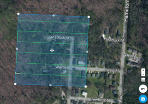
Specifically, in the Waxahachie, TX and Ellis County area, civil engineers offer the following types of civil engineering services:

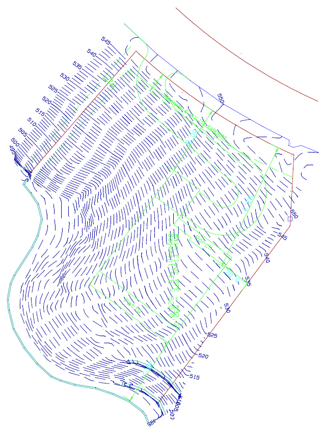
Residential Land Development (single-family & multi-family land planning & subdivision design, lot layout planning, land development master planning, site utility plans, earthwork grading plans, and traffic circulation plans)Commercial Land Development & Design (Apartments, Hotels, Restaurants, Shopping Centers, Convenience Stores, Banks, Industrial Parks, and Churches)Sanitary Sewer System Layout & Design (Single family, multi-family & commercial)Storm Sewer Systems Layout & Design (detention ponds, gutters, storm drains & piping, FEMA Letters of Map Amendment, and storm water flood studies)Drinking Water System Planning & Design (wells, city water mains, fire prevention systems)Transportation Engineering (traffic studies, transportation system plans, urban planning, corridor studies, feasibility studies, and highway engineering)
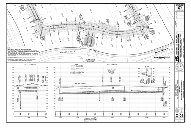
civil-engineering.bmp?profile=RESIZE_584xRoadway Design (horizontal curve design, superelevation design, route planning & design, vertical curve design, pavement design, curb layout & design, D.O.T. highway permits, road crossing permits, and road boring permits)Pipeline Engineering (route planning, pipe sizing, corridor studies, feasibility studies, and easement and land acquisition)Construction Engineering (project management, construction management, construction plan design, quantity estimation & takeoffs, contractor selection, construction oversight, construction surveying, and as-built drawings)Environmental Engineering (Phase I Environmental Assessments, NPDES storm water permits, erosion & sediment control design plans, septic system design & approval, septic treatment system design, wetland delineation & surveying, Corps of Engineers permitting, and wetland mitigation plans)Geotechnical Engineering (foundation design, retaining wall design, soil proctor compaction testing, standard penetration testing, nuclear density testing, and Atterberg limits)Structural Engineering (retaining wall design, foundation design, slab design, building structural design & analysis, structural design plans, wall designs, roof designs, hurricane loading designs, and bridge design)Mechanical Engineering (heating, ventilation, and air conditioning, HVAC design, plumbing design, steam plants, humidifying/dehumidifying, water treatment & filtration systems, vacuum systems design, natural gas piping system design, medical & veterinarian gas systems)Electrical Engineering (Lighting design, building electrical design, fire alarm systems, generator system design & specification, security system design)Expert Witness Consulting & Testimony (expert reports, deposition testimony, and courtroom testimony)

The civil engineer must have a working knowledge of all of the above items, depending on the specialty chosen. Even a specialist must be able to understand how all of the different types of engineering fit together on various project.

Enclosure: https://landsurveyorsunited.com/almanac/civil-engineering
Reply to this post...
Boundary Dispute

You may have read  the land surveyor from Newnan's post about what a Boundary Survey is.    Today I want to talk about Boundary Disputes.  In fact, I want to point out 3 types of Boundary Disputes and explain the differences.

In response to many requests for advice on boundary disputes we have compiled a set of guidelines but ultimately if the case is unresolved, due to the complexity of the law, you will need to contact a specialist lawyer. First and foremost with any boundary dispute you need to establish the facts before discussing these with a neighbor to try and resolve the issue amicably or before taking the matter further with legal action.

There are, in fact, three main types of disputes (name more in the comments if you know of others):


First Type of Boundary Dispute: Encroachment - The Primary type

Boundary Disputes and Encroachments in surveyingThis is when a neighbor builds a structure (building, shed, garage, landscaping, fence or an addition/improvement to an existing building) that crosses the boundary line of your property. Often the reason for this is poor planning or unclear boundary lines. In this instance you will need to get a land survey to establish with certainty that encroachment has taken place. In addition, if it is a building, the local town planning office will hold records of the accepted plans that were drawn by your neighbour for building consent. These records can be made freely available to you. It will be worth checking that firstly the building is within the confines of the plans and secondly that your independent land survey is in agreement with the boundaries as set in the plans. Use the land survey to try to resolve the issue amicably with your neighbour before taking legal recourse. You need to be sensitive to you and your neighbor's quality of life because after a legal dispute this may be severely impacted.


Second Type of Boundary Dispute:  Trees

Boundary Disputes over trees in surveyingTechnically this is still termed as encroachment as above but it does have some unique facets. Importantly a boundary is three dimensional, it gives you rights to the earth below, such as mineral or oil rights and rights up to the sky. Therefore an over hanging branch is encroachment. The difficult area here is whether the tree is considered a boundary tree, in which case no one owns exclusive rights to the tree and the neighbors are classed as tenants in common.


Third Type of Boundary Dispute:  Easements

Easement Boundary Disputes and Easements in land  surveyingEasements are legal documents that give access rights to a person who is not the owner of the property. The standard reasons to have an easement is for service companies to gain access to their structures that may cross your property such as electricity pylons, telegraph poles, water and sewage pipes. Easements are also often used to define the shared use of a drive or a drive that crosses a neighbor's property. In addition to trails and roadways these will be shown in your property title deeds and you will need to refer to these to establish if you have a case for legal action.


As well as the above three main reasons, there can be restrictions on the use of the land or property

A right to legal action can exist if the use of the neighbor's property causes distress to your quality of life, by increased noise levels or too intensive lightening, or if the land is being used outside any covenants or restrictions that applies to your local area, often termed as CC&Rs

Try to resolve the dispute with your neighbor with a meeting and if that fails then you should counsel a lawyer for advice and guidance.


Another great article to check out by Deward Karl Bowles in Texas  

The Land Surveyor and Adverse Possession in Texas
Enclosure: https://landsurveyorsunited.com/almanac/boundary-dispute
Reply to this post...
Affidavit of Merit

An affidavit of merit is a requirement in some jurisdictions, primarily in medical malpractice claims, to have an expert file an affidavit stating the claim has merit. It is a measure enacted to deter frivolous lawsuits. When a plaintiff in a medical liability lawsuit does not file an affidavit of merit with the complaint, the case may be dismissed. Below is a detailed explanation of Affidavit of Merit for State of Texas

Affidavits of merit, sometimes referred to as a certificate of merit, in the most general of terms, are affidavits signed by an expert in the field, attesting to the merit or merits of a claim.  Depending on the state, affidavits of merit may be required in medical malpractice claims, legal malpractice claims, and other claims involving some sort of professional negligence.  This may include cases against architects, accountants, engineers, land surveyors, real estate agents, as well as design professionals.

Affidavits of merit are a product of tort reform efforts.  It is believed that requiring a party to file an affidavit of merit, either contemporaneous to or shortly after filing a lawsuit, accomplishes several goals, including:

Reducing the number of suits being filedReducing the amount of money put towards settling claims of questionable valueLimiting the types and amounts of liability insurance professionals must carryLimiting the number and types of decisions made not out of professional judgment but rather fear of a potential lawsuit

Because, by and large, affidavits of merit require a professional in the field to opine under oath about a failure to meet a minimum standard of care, it is believed frivolous claims will be reduced, if not eliminated.  Affidavits of merit also necessarily limit the extent of claims made to that which can reasonably be proven based on the facts and circumstances of a given case.

Enclosure: https://landsurveyorsunited.com/almanac/affidavit-of-merit
Reply to this post...
2015 ALTA Survey Correction

In 2015, I performed an ALTA survey on +/-150 Acres of land.  Recently, I dicovered an error which requires a 6' shift on a portion of the boundary.

What is the proper procedure to correct this?

Enclosure: https://landsurveyorsunited.com/almanac/2015-alta-survey-correction
Reply to this post...
GUNTER'S CHAIN

GUNTER'S CHAIN is A measuring device composed of 100 metal links fastened together with rings. The length of the chain is 66 feet. The source of the term "chain" is frequently used in tape and steel tape measurements in surveying.

Gunters ChainIn 1620 an English mathematician and astronomer named Edmund Gunter described a surveyor's chain with 100 links, measuring 66 feet (22 yards or 4 poles) overall. By this design, one square chain equals 484 square yards, ten square chains equal an acre, and eighty chains equal a mile. Gunther's design proved extremely popular, especially in English lands. This example belonged to John Johnson (1771-1841), the Surveyor General of Vermont. It is made of steel, with round handles at either end, brass tallies every 10 links, and swivels every 25 links. Each link is joined to the next by three rings, and each unit (link and three rings) is 7.92 inches long.

How long is a Gunter's chain?

22 yards
 
Surveyor's chain, also called Gunter's chain, measuring device and arbitrary measurement unit still widely used for surveying in English-speaking countries. Invented by the English mathematician Edmund Gunter in the early 17th century, Gunter's chain is exactly 22 yards (about 20 m) long and divided into 100 links.
 
Why is a chain 66 feet?
The chain was originally called an "acre's breadth", because it was the width of a acre, while a furlong was the length. Edmund Gunter, a clergyman and mathematician, invented a measuring device called a chain. It was the forerunner of the slide rule. The chain was 66 ft (20 m) long.
 
How many Gunter chains are there in one mile?
eighty chains
 
In 1620 an English mathematician and astronomer named Edmund Gunter described a surveyor's chain with 100 links, measuring 66 feet (22 yards or 4 poles) overall. By this design, one square chain equals 484 square yards, ten square chains equal an acre, and eighty chains equal a mile.
 
Reply to this post...
Y Terms in Surveying

Y – The latitude or distance along the north-south axis in a coordinate system.

Enclosure: https://landsurveyorsunited.com/almanac/y-terms-in-surveying
Reply to this post...

Land Surveyor Forum - Land Surveyors United - Global Surveying Community
Looking for a Sokkia DOC210 data transfer cable or Hirose female connector of that cable

I've got the old Sokkia NET2 Monmos (new Topcon MS1AXII) to hook up to a RS232 port.

Does anyone have a cable (DOC210) or a connector or the description of the female hirose connector that fits underneath?

All info is highly appreciated.

Thanks,

Arjen

Enclosure: https://landsurveyorsunited.com/forum/topics/looking-for-a-sokkia-doc210-data-transfer-cable-or-hirose-female-
Reply to this post...
Surveying Newbie

I'm looking for information on how to get into the surveying field.......where does one begin?

Enclosure: https://landsurveyorsunited.com/forum/topics/surveying-newbie
Reply to this post...
Plat Error

The distance of the closing course of plat S-142 (Search Official Records - Phil Diamond - Orange County Comptroller (occompt.com)), which is 900.48', is not the sum of the individual courses. I get a sum of 786.88'. What do you get?

Enclosure: https://landsurveyorsunited.com/forum/topics/plat-error
Reply to this post...
Attachment tripod screw size in Sokkisha TS20

Hi, 

I've just bought an old Sokkisha TS20 theodolite, and I realize that the attachment screw size is not the usual 5/8", but much bigger, somewhere around 1 3/8" (I measured about 34 mm). Does anybody know if there's a tripod with that size of screw, or if adapters from 5/8" to 1 3/8" exist?

Thanks to everyone.

Attached I put 2 pictures.

Mirko10853639068?profile=RESIZE_710x10853639091?profile=RESIZE_710x

Enclosure: https://landsurveyorsunited.com/forum/topics/attachment-tripod-screw-size-in-sokkisha-ts20
Reply to this post...
Code with Leica total station
Please is their anyone who can assist me on how to add codes to my total station instrument or send me a video on how to go about it. Thanks
Enclosure: https://landsurveyorsunited.com/forum/topics/code-with-leica-total-station
Reply to this post...
New DJI M350 Review!

For those wondering what's new and improved on the new M350 RTK from DJI, Logan Campbell from Aerotas just put out a video review! Those with current drone programs or those thinking about starting a drone program could find it useful. Aerotas provides drone data processing for US-based Land Surveyors and Civil Engineers.

Contact Aerotas here!


Enclosure: https://landsurveyorsunited.com/forum/topics/new-dji-m350-review
Reply to this post...
Interviews Needed!

Hi! I’m Mike from Aerotas, and I’m working on new drone data solutions for Land Surveyors and Civil Engineers.  I’m reaching out because whether or not you work with drones, Aerotas wants to hear from you! If you’re open to a short (30-45 minute) customer interview, please reach out to me at [email protected] to set up a time to chat! Looking forward to connecting!

Enclosure: https://landsurveyorsunited.com/forum/topics/interviews-needed
Reply to this post...
Surveyor Bookmarklets For On-The-Fly Posts to Community From Anywhere

Let's work smarter, not harder. How many of you have ever used  a bookmarklet?

How can a Bookmarklet Be Helpful to a Land Surveyor?

A bookmarklet is like a tiny wizard that lives in your browser's bookmarks bar and can magically transform any webpage with a single click. To add a bookmarklet, simply drag and drop it into your browser's bookmarks bar. Once it's there, you can summon its power by clicking on it while you're on any webpage. Voila! The bookmarklet will work its magic and do whatever it was designed to do - whether it's highlighting text, translating a page, or just adding some extra pizzazz. So go ahead and add a bookmarklet or two to your toolbar and watch your browsing experience become even more enchanting! Simply click, hold and drag any of the following Bookmarklets up into your browser bookmarks bar for quick access from anywhere. Then, when the mood strikes, simply click the bookmarklet and it will take you right to where you want to go for a quick post.

1) Right click on your browser toolbar and create a folder, call it "LSU" 2) Drag any of the following bookmarklets into that folder 3) Now anytime you have something to share, no matter what website you are on, simply click one to start a post. Easy as that! how to use bookmarklets Bookmarket for Quickly Posting to Surveyor Forum

Bookmarket for Quickly Posting to Videos

Bookmarket for Quickly Posting to Articles

Bookmarket for Quickly Posting to Surveyor Blogs

Bookmarket for Quickly Posting to Surveyor Dictionary

Enclosure: https://landsurveyorsunited.com/forum/topics/surveyor-bookmarklets-for-on-the-fly-posts-from-anywhere
Reply to this post...
Topcon PS-103A Power Station 3 Robotic Total Station

Up for sale is a Topcon PS-103A Power Station 3 Robotic Total Station kit in excellent condition, it comes with:

1x Topcon PS-103A Power Station 3
1x ATP1 360 degree prism
1x Topcon RC-5 Remote Control
1x Lens Hood For PS-103A
1x Battery charger
1x Hard carrying case with transport straps
1x Battery for TS

Asking for $8500

Pm me if interested.


10784795469?profile=RESIZE_710x

Enclosure: https://landsurveyorsunited.com/forum/topics/topcon-ps-103a-power-station-3-robotic-total-station
Reply to this post...
Limited special review 1968

Hi 

I'm new to the site so hope I'm on the right forum for this type of question.

I'm working on a legal case and wonder if anyone can help. During a Limited Special Review in 1970 in England the parish council trying to get the status of a way changed from a Rupp to a Boat filled out a standard questionnaire. On this questionnaire they stated that the recorded definitive width of a way has been incorrectly recorded on the original map and statement as an average of 4 feet and should have been recorded as a minimum of 6 feet. The County Surveyor then went out and reported that the Rupp in question was suitable for re classification to a Boat. The definitive map and statement were  changed to show this as a Boat however the width was not altered and to this day shows a stated width of an average of 4 feet. The Byway has boundary features along its entire length and at its narrowest is at least 6 feet (probably closer to 7 feet ). At its widest its about 16 feet. In the opinion of any Surveyors here who are familiar with this review should the width also have been changed on the definitive statement at this time to show the correct width in line with the Parish Councils comments. Also were surveyors at this time issued guidance as to what the minimum width should have been for a Boat under this review . Any knowledge would be extremely helpful and if any members can point me towards the guidance from this time or even show it that would be extremely helpfull.

obstructions have been placed outside of a property boundary wall that now narrows the byway to about 9 feet from12 feet. The council are saying this can't  be an obstruction as there is over 4 feet of room still available and that any attempt to have the obstructions removed would be defended as a " Serious dispute " and give the magistrates court no option but to not enforce an order for removal. I'm arguing that had the map been updated as is the statutory duty of the council. A minimum of 6 feet would of course include a width of 12 feet.

Thank you in anticipation.

Enclosure: https://landsurveyorsunited.com/forum/topics/limited-special-review-1968
Reply to this post...