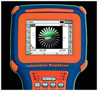
Hi all,
I have TDS Rrecon without bluetooth and i connect to my GSR2700 ISX trought cable. SurvCE log this reciever, then i select internal GSM and make NTRIP connection. Controler recieve list of base stations but and succesfuly connect to reciver at te end. When i try to survey it stays in auto mode do not recieve fix position. CAn enybode tell my why i have this problem?
Thanks
Bojan Petkovic
Hi,
today for the first time I noticed that my GRX1, or perhaps the Spectrum Survey Field (I don't know if it is the software or the GPS) records the measurements with a completely wrong date.
When there was the rollover week I installed the recommended firmware on the GRX1 (version 4.7-10). After that I had never noticed if the acquisition date was correct or not.
Today, having made a continuous acquisitions, and needing to synchronize the measurements with the data of another instrument (magnetrometer), I noticed that the dates recorded by the Spectrum Survey Field are completely wrong. (I have Spectrum Survey Field version 8.2.3 installed on a SHC2500 controller).
Can comeone give me some advice to solve the problem?
Many thanks and kind regards,
Massimo
Good day.
I am looking for assistance in transferring data to my Sokkia 3030r from txt. file. This data was extracted from Cad file / cogo points. I have Pt, North, East, Elev, code format. (comma del) I also created an .SDR file. I am playing around with both Spectrum link and Sokkia link and I cannot manage to transfer to data to the machine. I am missing a component and can't find much information online. I bought a new Compact flash card. (64mb), a low storage card (this is what I understand as being required for the older machine). I formatted the card using the machine. I tried both SDR20 and SDR33 files. from the new card. Card to Mem > I get a "There are no entries" pop up. I also tried transferring from app - Spectrum link, and sokkia link with no success.
I assume my txt format or SDR file is not formatted correctly or something ?? Anyone out there have tips or recommendations?
thank you kindly
Shawn
I have a SOKKIA SET250X total station in chinese default language and
any time I tried to change the language by clicking on 'OTHERS' and
LOAD, it always tell me to download the language. Please, how will I
go about changing the default language from chinese to English? Is
there any software for the language conversion? or any method in
changing the language?
Thanks in anticipation for your warm reply.
I recently received a Pentax PCS-2s total station from another surveyor as a gift but i am having a few challenges. I have read the manual for three times now but i have still been unable to solve my little situation. To make coordinate observations one will have to input in the station coordinates and make a back sight observation but my challenge is, when inputting in the station coordinates i am allowed only five slots to key in my digits but my eastings are six digits. IMG-20150328-00197.jpg
Welcome to the Pentax Group Forum, created by John Anderson. Please use this "Start a New Discussion" feature to make comments, ask questions, and provide solutions for other Pentax users in the UK and elsewhere around the globe.
Enjoy the group!
Scott D. Warner, RLS
Senior Director / Editor
Land Surveyors United
Hello Group,i imported a used Pentax labeled R-330c which i found out after importation that its in Japanese language and its very expensive to return it to Japan. please dear Group can someone help me with ideas how to change it to English?
Hello to all new Pentax members and any one else who is interested. My Pentax R235N has been tampered with by "others" and the settings are all mixed up.
What I need to know is what is the default settings for the UK.
I would call myself a "novice to capable" surveyor with no peers or associates to get help from, this is why I'm posting this request on LSU.
I have attached the Pentax options for Coordinate axis definition.
I look forward to any pointers and suggestions to resolve this problem.
HI dear friends
this is my first work that i have uploaded and its a spreadsheet of leveling using RISE and FALL method
enjoy
Are you tired of using spreadsheets and are looking for a more faster and efficient way of performing your calculations both on-site and at the office??
What if I told you that was possible. I am an Engineering Surveyor and also an app developer. I can turn any surveying calculation into an app to make your life much easier.
Please see the youtube video below of a basic app that I have created as an example and also the play store link.
Youtube link: https://www.youtube.com/watch?app=desktop&v=B8l0Zar3sKk
Play Store: https://play.google.com/store/apps/details?id=com.sbusisomasilela.surveyingApp If you have trouble with this app just email me and I will send you the apk directly.
For more contact me on [email protected]
In this downloadable spreadsheet calculator you are able to calculate Area by Coordinates. Calculating the area of a land by coordinates using an Excel spreadsheet is a quick and easy process for land surveyors. In this blog post, we will guide you step by step on how to perform this calculation.
Step 1: Input Coordinates
Input the coordinates of the land into Excel in two separate columns, one for X and one for Y. Make sure the coordinates are in the same order that you would traverse the boundary of the land.
Step 2: Create a Formulas
To calculate the area, we will use the Shoelace Formula. This formula uses the X and Y coordinates to calculate the area of a polygon. In Excel, create a third column and enter the formula: = (X2Y1-X1Y2)+ (X3Y2-X2Y3) +... + (XnYn-1 - Xn-1Yn)
Step 3: Apply the Formula
Now that the formula is in place, you can apply it to the entire column by clicking and dragging the cell containing the formula down the column. The result of each cell will represent the area of a small triangle formed by the coordinates.
Step 4: Sum the Area
Finally, sum the area of all the triangles to get the total area of the land. In Excel, you can simply click and drag the bottom right corner of the cell with the formula to automatically copy it down the column, and then add the entire column of numbers to get the total.
Step 5: Finalize
The final result will be the total area of the land in square units (e.g. square meters, square feet). You can format the cells as desired and even create charts or graphs to visualize the results.
In conclusion, calculating the area of a land by coordinates using an Excel spreadsheet is a straightforward process that can be completed in just a few steps. Whether you are a seasoned land surveyor or just starting out, this method can save you time and increase accuracy in your calculations.
Download Get Area by Coordinates - Land Surveyors United.xlsx
If you want smaller file sizes try this: Saving an Excel file as an .XLSB will shrink the size by half or 75%.
This is a helpful download of GeoPro 2022, the premier spreadsheet tool designed specifically for your needs. Whether you're working on a simple or complex survey project, GeoPro 2022 has you covered with its comprehensive set of features and calculations. GeoPro 2022 streamlines the survey process and makes it easier for you to get the results you need.
With its user-friendly interface and intuitive design, you can perform complex calculations with ease and accuracy. Whether you're calculating elevations, determining the volume of a cut or fill, or performing any other survey-related calculation, GeoPro 2022 has the tools you need to get the job done. So why wait? Get your hands on GeoPro 2022 today and see how it can revolutionize the way you work. Download it now and take the first step towards improving your survey workflow. We're confident you'll love the results!
I've pulled a DTM-300 out of the closet after a company merger and I don't have the user manual. I did a quick field test and found that it needs a vertical/horizontal angle adjustment. Does anyone have a manual with instructions on how to do a field adjustment?
Hello, I use NIKON DTM 322 with on-board programs and data collector. I also use Land Desktop 2009 for my computation. When doing the download and upload, I use MSCAD-2009 using cable through COM1. The download is OK and I can download all my field work from total station to PC without any problem but when I try to do the upload, it keep giving me error "Check Data Line 1". I use the same format P,N,E,Z,D for both upload and download and don't know what is going on. Would someone please help me with this or have any idea about it? Your help/comment will be greatly appreciated.
Alex
Hi all,
Looking for a manual for the subject auto-level. In particular I need the specs for a proposal. My company doesn't have the manual. If someone could scan the pertinent page I would be forever grateful. Thanks
email:[email protected]
Hi all,
I have recently hired a Leica TS15 Robotic total station and all is going well. However, when I go to export my surveyed points to a memory stick as a DXF file and open that DXF file in AutoCAD, my points do not display the name that I assigned to them from my controller while I was surveying them (see image bottom). This makes it very hard to know which point is which.
Before receiving my TS15, I was using a Leica TS12 Robotic total station and when I exported surveyed points as a DXF file and opened it in AutoCAD, my points were displayed with the name I had assigned to them from my controller while surveying those points along with their easting and northing co-ordinates and their reduced level (see image top).
There must be some setting that I do not know about, which I can change to correct this issue. Has anyone come across this issue before? If you have I would be very grateful if you'd let me know how to fix it.
Cheers,
Nick.
Anyone is familiar with Leica Geiod Reader?
Am trying to use the old fashioned RTK with GSM. I use a GX1230 with Siemens M20 (GX1230 Tech Ref Manual lists M20 as a supported model). Connected the M20 to Port1, configured the Real Time Interface with Port1 and Siemens M20 that shows up by default in Smartworx with factory default AT commands. I create a Config Set for Rover, all done and Smartworx shows messages, 1. Config Set saved, 2. Port1: No response from GSM and 3.Port1: GSM Initialised. The SIM I use has both voice and data from the service provider. I do not have a Network RTK Infrastructure, so I am doing a Single Base to Single Rover RTK. Under Additional Rover Option, Accept Reference is "Any Received" and Ref Network is "None" (as I dont have a Network RTK Infrastructure).
Begin Survey, Press F3 CONEC, Screen shows Dialling 'mobile number', and immediately, it throws up 'Connection interrupted' error in Smartworx.
When I use AT commands on M20, I am able to call my mobile (rings) and from my mobile to the M20 unit, smartworx displays connection established. But its when I dial via smartworx, from Rover to Base, smartworx throws up this error almost immediately. Have struggled with it for 2 weeks.
Appreciate if you can throw some light. Thank you.
Dear everybody,
It's nice to be a part of your 4rum.
Firstly, I would like to introduce with you I am Hieu, Survey Manager of Hitachi Railway Line 1 in Ho Chi Minh City in Vietnam. Our company has just bought the TS16P 1" for my Survey Team, unfortunately, so far I cannot know how to import our project alignment data including super elevation, slope, cant, etc., to my Total Station.
Could you please help me to solve this matter?
Thank you so much in advance.
Kind regards,
Hieu.
I'm using a Trimble XRS GPS with Terrasync 2.30 Pro. I would like to enter state plane coordinates into the hand held logger, and then use the navigation function to locate said coordinates in the field. Can someone point me in the right direction, or to a decent tutorial? Thanks!
I am a home builder that purchased a 5603 with TCS2 data collector running Surveyor Pro 4.7.
I have no experience in surveying but I am slowly learning to use the machine.
My question or problem is I have experimented with staking out a 25'x25' square in my driveway which is pretty level. When I check the points and square it up, it's dead on.
I then tried in my yard with a decent slope. It's telling me it's roughly a 3' drop in 25'. That point is off about 2". I'm not sure how to correct this or what I am doing wrong.
Any help would be appreciated!
Thanks, Mike
DOES ANYBODY KNOW OF A INSTRUMENT REPAIR FACILITY THAT WILL WORK ON THESE? PREFERABLY IN S.C.. THE TRIMBLE PEOPLE DON'T SUPPORT IT ANYMORE. THEY WILL WORK ON THEM BUT THEY ONLY REPLACE PARTS, WHICH ARE GETTING HARD TO FIND. THEY WON'T TRY TO FIX A COMPONENT.
I've recently started using a trimble s8 total station and I'm having problems completing calibration steps. I can't understand the instruction in the manual for adjusting the trunnion and I'm not able to calibrate the auto locking because the instrument is not allowing me to manually center the cross-hire on the target even if I disable auto lock before starting the calibration routine. I need some advice can anyone help me?
When I set up my BRx7 system for base & rover, my base remains on autonomous. Is this normal?
Hi can anyone please help. I am splitting a large cadastral layout into managable portions. After doing the initial site localisation I want to use this same localisation file for each of the portions as separate surveys without revisiting all the points used in the localisation yet starting each portion as a new job. Is this possible? I thought of doing the localisation as a job then saving it to the pc, then renaming this file for each of the portions of 100+ plots being surveyed
I have a weird scale (1:14726.5) that just took over and can't get back to the usual Ex: 1"=50'. Carlson Support hasn't been able to help. We've tried different setting changes.Scale.pdf
Has anyone had this problem?
A fellow member asked me if I had a manual handy for Topcon Tesla Data Collector. You can find it available for download below. You can also find a review here on the site
If you want to advance your knowledge or are interested getting deeper in to new topics you have been aware of from a distance, Topcon’s e-learning platform has been made free of charge while we all face challenging times. Make use of the extra flexibility in your work schedule to check out educational opportunities from myTopcon eLearning without the need for travel. For a limited time all of Topcon’s eLearning courses are being offered free of charge. Just use the coupon code: CABINFEVER at checkout to get 100% off eLearning courses in your shopping cart. To access the eLearning offerings, visit myTopcon.com and click on the “Training” tab. Ranging from beginner introductions to core technologies like GNSS through to advanced workflow training on Road design and the Smoothride product; the courses and content available covers the full width of our solutions portfolio and include tests along the way to keep you attentive.
When things return to normal, you’ll be more educated than ever, and ready to take on new challenges.
I went out and shot a couple points to use for the college course I teach. When I came back to the office my computer crashed with my Topcon tools and Pinnacle on it. Can somebody convert these to rinex for me. And if possible solve the small network.Thank you much, Dave
6217- Slant :4.83' (1.472m) - Vert.:4.74' (1.445m)
Start: 12:54pm EDT End: 1:39 pm EDT
6288 - Slant:5.155' (1.571m) - Vert: 5.06' (1.542m)
Start: 1:02 pm EDT End: 1:47 pm EDT
Hold CTNE N: 806,142.76
E: 1,009,694.66
Ortho 233.27'
Looking for any surveyors that may have experience using the Topcon LPS machine control system.
Mainly looking for some help on the data prep end.
Any help would be greatly appreciated.
Thanks!
Good afternoon,
I am just about to launch a new small business called Ground Control Surveys.
I live in Sydney, Australia.
The business will offer both UAV Mapping and Processing.
Having read a whole lot of forums over the last few years, I have seen that there are a large number of people who want to take advantage of UAV's for mapping, but who don't have the time to experiment with all the processing software/s.
For those local to my area, I can fly the drone (Licensed CASA pilot) and process the images.
But for those who may be interstate or overseas; I am more than happy to process the imagery that you may have taken.
I can also discuss the flight planning, ground control placement, camera settings etc with you, to ensure the imagery is of sufficient quality.
I have refined the process over the last 2 years and have found that Photoscan allows for the most customisation, which, done correctly, leads to the most accurate results; however, if you require the imagery processed in similar software, that can usually be arranged.
If anyone would like to know more, I can share with you my past projects and the accuracy analysis.
I can also assist with the analysis after the processing is complete eg. categorising the point cloud, creating a bare-Earth model, generating contours and exporting them as a DXF, creating a 10 x 10m grid and sampling heights at these locations etc.
Don't hesitate to ask any questions, I'm happy to share some quick tips on this or any related topics (QGIS, GlobalMapper etc).
Kind regards,
James Wallace
Hi Guys
I got my photo control and processing all figured out for Normal projects with good geometry but im having a hard time figuring out how to place and space control points for narrow road strip.
Check out this collection of Drone Surveying Videos for learning the basics related to surveying with UAVs and Drones.
We have recently acquired an eBee plus and interested in others experience and tips in optimizing the workflow in Agisoft, in particular using a geoid model where the local geoid model is not well defined (outside South Africa) We always use accurate ground control points to verify results. The geoid model is fairly well defined in South Africa with an accuracy or standard deviation of 7cm. Has anyone used a geoid specific to Africa and verified against true orthometric heights, and if so where?
I stumbled across a terrific resource called Drone Made which outlines the legality of operating drones in pretty much all countries of the world. Following drone rules can be a hard thing to do, especially if you are continuously travelling. We are a community of travellers from all around the world & created the first truly global and up to date Drone Laws World Map(s)!
European Drone Laws
EuropeLiechtenstein
Montenegro
San Marino
Serbia
MicroSurvey CAD is a Complete Desktop Survey and Design Program Created for Surveyors, Contractors and Engineers.
No plug-ins or modules are necessary. Complete Survey Drafting, COGO, DTM, Traversing, Volumes, Contouring, Point Cloud manipulation and Data Collection interfacing are included. MicroSurvey CAD is compatible with field data from all major total stations and data collectors and is fully compatible with AutoCAD.
Top Feature Details>>
New:
MicroSurvey CAD Ultimate is now available and supports point cloud & LIDAR data - along with some pretty incredible, time-saving utilities. See the Top Features and Version Comparison pages for more information. MicroSurvey CAD is now bundled with MicroSurvey inCAD 2010. If you purchase one, you get the other. Move the USB Key to the machine you want to use. Run AutoCAD at the office and MicroSurvey CAD at home.
|
The MicroSurvey CAD Advantage
Surveyors all over the world use MicroSurvey CAD to complete their infrastructure and design projects. MicroSurvey has been building software for the surveying industry for over 20 years and with all this experience, we are able to offer the best surveying CAD software package available today.
We understand that not everyone needs a full featured package, so we offer 4 different options. Our Basic version has core surveying computation tools and just enough CAD tools to draft a plan. The Standard version has all the features of Basic, plus a full CAD engine. The Premium version, which has everything you expect in a Survey software package including advanced design capabilities. Completing the line is the Ultimate version, which has all features enabled, including point cloud processing tools.
MicroSurvey has been developing its desktop software on the IntelliCAD engine for over 4 years. MicroSurvey CAD opens and saves AutoCAD drawing files (V2.5 through 2011) and uses DWG as its native format. IntelliCAD’s command set, toolbar and menu structure is very similar to AutoCAD so you can install MicroSurvey CAD into existing AutoCAD environments with ease!
Constant Improvements are an important aspect of a software company and a software package. Take a look at the list of features that have improved in the past 4 major updates to MicroSurvey CAD:
2010 Upgrade Features 2009 Upgrade Features 2008 Upgrade Features 2005 Upgrade FeaturesIn addition there were major upgrades in 2004, 2002, and 2001.
We value and listen to our customers and we support what we build. MicroSurvey’s technical support has been ranked number one by industry professionals and our customer service is world class. MicroSurvey CAD includes over 12 hours of extensive training movies, which equates to reading thousands of pages of manuals. Learning while you work has never been this easy.
Visit the MicroSurvey Store to Buy Online>>
hi. i hope there are people out there using embedded cad and can answer questions i can't find in there wonderful videos.
we are converting over from the great antique land desktop 3. been using it for 20 years now but need to upgrade our survey software. i don't want to use civil 3d.
we have field genius and love it so we went with embedded cad. my biggest question is points. i just want to change the node from a dot to an X. they show you how in the intellicad version but not for embedded cad, popups don't look the same
Respected sir,
Please help me to transform the latlon coordinates to UTM manually how can i solve it manually
THANK YOY
In an official press release from Microsurvey, we learn of their new acquisition by Hexigon:
FOR IMMEDIATE RELEASE
January 19th, 2012 – MicroSurvey is excited to announce that The Hexagon Group has entered into an agreement to acquire all outstanding shares of MicroSurvey Software Inc., the leading Canadian based developer of surveying and mapping software for the land surveying, construction, and forensic markets.
"MicroSurvey has grown very rapidly in the last 2 years and the acquisition by Hexagon gives us the means to grow even faster and keep pace with the ever-growing customer demand. Our team is extremely excited about this acquisition as it provides us the vehicle for further investment in innovation and greater access to the market", stated Darcy Detlor, president of MicroSurvey Software. Mr. Detlor will continue as president of MicroSurvey.
Headquartered in Kelowna, British Columbia, MicroSurvey currently employs 30 people. With a successful expansion of its footprint in recent years, today the company provides innovative software solutions to customers around the world.
"The acquisition of MicroSurvey notably expands Hexagon's product offerings and software development capabilities for several of our key markets including land surveying, construction and public safety." said Ola Rollen, CEO and President of Hexagon AB. "Additionally, both MicroSurvey's software products and Hexagon's instrument products enjoy strong leadership positions in these markets". "The ability to offer such comprehensive, market-leading and innovative solutions will undoubtedly benefit both current and future customers of Hexagon."
About MicroSurvey
MicroSurvey Software Inc. has been developing software and hardware solutions for surveying, forensic mapping, and data collection for over twenty-five years. With customers in over 100 countries, MicroSurvey Software is a two-time winner of PROFIT Magazine's 100 Fastest Growing Companies and a winner of the Deloitte Technology Fast 500. Both have recognized MicroSurvey Software for its outstanding sales growth.
About Hexagon
Hexagon has over 12,500 employees in more than 40 countries and net sales of about 2,200 Million Euros. Their products are used in a broad range of industries including surveying, power and energy, aerospace and defence, safety and security, construction and manufacturing. Learn more at www.hexagon.com.
Press Release from Hexigon
Hexagon has entered into an agreement to acquire all outstanding shares of MicroSurvey Software Inc., a leading Canadian based developer of surveying and mapping software for the land surveying, construction, and forensic markets.
Headquartered in Kelowna, British Columbia, MicroSurvey currently employs 30 people. With a successful expansion of its footprint in recent years, today the company provides innovative software solutions to customers around the world.
"The acquisition of MicroSurvey notably expands Hexagon's product offerings and software development capabilities for several of our key markets including land surveying, construction and public safety." said Ola Rollen, CEO and President of Hexagon AB. "Additionally, both MicroSurvey's software products and Hexagon's instrument products enjoy strong leadership positions in these markets". "The ability to offer such comprehensive, market-leading and innovative solutions will undoubtedly benefit both current and future customers of Hexagon."
Excluding inter-company sales, MicroSurvey's turnover in 2010 amounted to approximately 2 MEUR.
For further information please contact: Mattias Stenberg, Vice president Strategy & Communications, Hexagon AB, +46 8 601 26 27, [email protected]
MicroSurvey has announced that The Hexagon Group has entered into an agreement to acquire all outstanding shares of MicroSurvey Software Inc., the leading Canada-based developer of surveying and mapping software for the land surveying, construction and forensic markets.
"MicroSurvey has grown very rapidly in the last 2 years and the acquisition by Hexagon gives us the means to grow even faster and keep pace with the ever-growing customer demand. Our team is extremely excited about this acquisition as it provides us the vehicle for further investment in innovation and greater access to the market", stated Darcy Detlor, president of MicroSurvey Software. Mr. Detlor will continue as president of MicroSurvey.
Headquartered in Kelowna, British Columbia, MicroSurvey currently employs 30 people. With a successful expansion of its footprint in recent years, today the company provides innovative software solutions to customers around the world.
"The acquisition of MicroSurvey notably expands Hexagon's product offerings and software development capabilities for several of our key markets including land surveying, construction and public safety," said Ola Rollen, CEO and president of Hexagon AB. "Additionally, both MicroSurvey's software products and Hexagon's instrument products enjoy strong leadership positions in these markets. The ability to offer such comprehensive, market-leading and innovative solutions will undoubtedly benefit both current and future customers of Hexagon."